Dhaka (Bangla: ঢাকা, pronounced IPA: [ˈɖʱaka]; formerly known as Dacca, and Jahangirnagar, during Mughal era), is the capital of Bangladesh and the principal city of Dhaka Division. Dhaka is a megacity and one of the major cities of South Asia. Located on the banks of the Buriganga River, Dhaka, along with its metropolitan area, has a population of over 12 million, making it the largest city in Bangladesh.[2] It is the 9th largest city in the world[4] and also among the most densely populated cities in the world. Dhaka is known as the City of Mosques[5] and renowned for producing the world's finest muslin. Dhaka is also known as the Rickshaw Capital of the World. Approximately 400,000 cycle rickshaws run each day.[6] Today it serves as one of the prime centers for culture, education and business in the region.
Under Mughal rule in the 17th century, the city was known as Jahangir Nagar. It was a provincial capital and a center of the worldwide muslin trade. The modern city, however, was developed chiefly under British rule in the 19th century, and became the second-largest city in Bengal after Calcutta (presently Kolkata). After the Partition of Bengal in 1905, Dhaka became the capital of the new province of Eastern Bengal and Assam but lost its status as a provincial capital again after the partition was annulled in 1911. After the partition of India in 1947, Dhaka became the administrative capital of East Pakistan, and later, in 1971, the capital of an independent Bangladesh. During the intervening period, the city witnessed widespread turmoil; this included many impositions of martial law, the declaration of Bangladesh's independence, military suppression, devastation during war, and natural calamities.
Modern Dhaka is the center of political, cultural and economic life in Bangladesh.[7] Although its urban infrastructure is the most developed in the country, Dhaka suffers from urban problems such as pollution, congestion, and lack of adequate services due to the rising population. In recent decades, Dhaka has seen modernization of transport, communications and public works. The city is attracting large foreign investments and greater volumes of commerce and trade. It is also experiencing an increasing influx of people from across the nation, this has made Dhaka the fastest growing city in the world.[8][9]
History
Lalbagh Fort, constructed in the mid 17th century by Prince Mohammed Azam Shah, son of the Emperor Aurangzeb, and the Fort contains the tomb of Bibi Pari, daughter of Shaista Khan
The existence of a settlement in the area that is now Dhaka dates from the 7th century. The city area was ruled by the Buddhist kingdom of Kamarupa and the Pala Empire before passing to the control of the Hindu Sena dynasty in the 9th century.[10] The name of the city may have derived after the establishment of the Goddess Dhakeshwari's temple by Ballal Sena in the 12th century.[11] Dhaka and its surrounding area was identified as Bengalla around that period. The town itself consisted of a few market centers like Lakshmi Bazar, Shankhari Bazar, Tanti Bazar, Patuatuli, Kumartuli, Bania Nagar and Goal Nagar. After the Sena Empire, Dhaka was successively ruled by the Sultanate of Bengal as well as interruption of governors from the Delhi Sultanate before being taken over by the Mughals in 1608.[12]

The development of townships and housing has resulted into a significant growth in population came as the city was proclaimed the capital (Rajmahal) of Bengal under Mughal rule in 1608.[13][14][15] Mughal subahdar Islam Khan was the first administrator of the city.[16] Khan named the town "Jahangir Nagar" (জাহাঙ্গীর নগর; City of Jahangir) in honor of the Mughal emperor Jahangir, although this name was dropped soon after Jahangir's death. The main expansion of the city took place under Mughal general Shaista Khan.[14][15] The city then measured 19 by 13 kilometers (12 by 8 mi), with a population of nearly one million people.[17] British East India Company in 1765 gained right to collect revenue (Diwani right) and later took over governing in 1793 when Nawabs of Bengal were forced to abdicate all their authority over Bengal, Bihar & Orissa & the city passed on to total British control.The city's population shrank dramatically during this period as the prominence of Calcutta rose,[18] but substantive development and modernisation eventually followed. A modern civic water supply system was introduced in 1874 and electricity supply launched in 1878.[19][20] The Dhaka Cantonment was established near the city, serving as a base for British and Bengali soldiers.[15]
uring the abortive Partition of Bengal in 1905, Dhaka was declared to be the capital of the newly established state of East Bengal and Assam, but Bengal was reunited in 1911.[13][14][15] Following the Partition of India in 1947, Dhaka became the capital of East Pakistan. The city witnessed major communal violence following the partition of India.[15] A large proportion of the city's Hindu population departed for India, while the city received a large influx of Muslims. As the center of regional politics, however, Dhaka saw an increasing number of political strikes and incidents of violence.[15] The adoption of Urdu as the sole official language of Pakistan led to protest marches involving large crowds. Known as the Bengali Language Movement, the protests resulted in Pakistani police firing which killed a number of peaceful student demonstrators.[21] Throughout the 1950s and 1960s, Dhaka remained a hotbed of political activity, and the demands for autonomy for the Bengali population gradually gained momentum.[22]

The 1970 Bhola cyclone devastated much of the region, killing an estimated 500,000 people.[23] More than half the city was flooded and millions of people were marooned.[24] With public anger growing against ethnic discrimination and poor cyclone relief efforts from the central government, Bengali politician Sheikh Mujibur Rahman held a nationalist gathering on March 7, 1971 at the Race Course Ground.[15][21] An estimated one million people attended the gathering, leading to the March 26 declaration of Bangladesh's independence.[21] In response, the Pakistan Army launched Operation Searchlight, which led to the arrests, torture and killing of thousands of people.[25] After nine months of bloody battle with Indian Army and Mitra Bahini, the Pakistani Army surrendered to the Indian Army on December 16 marking the end of the independence war of Bangladesh.[26] As the nation's capital, Dhaka saw a rapid and massive growth of the city population in the post-independence period, as migrant workers from rural areas across Bangladesh moved to the city.[27] The growth of commerce and industry along with the city's population has created further challenges to services and infrastructure.[28] A real estate boom has followed the expansion of city limits and the development of new settlements such as Uttara, Mohammadpur, Bashundhara, Mirpur and Motijheel.[29]
Geography
Dhaka is located in central Bangladesh at 23°42′0″N 90°22′30″E, on the eastern banks of the Buriganga River. The city lies on the lower reaches of the Ganges Delta and covers a total area of 153.84 square kilometres (59.40 sq mi).[30] It consists of eight principal thanas –Lalbagh, Kotwali, Sutrapur, Ramna, Motijheel, Paltan, Dhanmondi, Mohammadpur, Tejgaon – and 16 auxiliary thanas – Gulshan, Mirpur, Pallabi, Shah Ali, Turaag, Sabujbagh, Dhaka Cantonment, Demra, Hazaribagh, Shyampur, Badda, Kafrul, Kamrangir char, Khilgaon and Uttara. In total the city has 130 wards and 725 mohallas.[31] Dhaka district has an area of 1463.60 square kilometers (565 sq mi); and is bounded by the districts of Gazipur, Tangail, Munshiganj, Rajbari, Narayanganj, Manikganj.[31] Tropical vegetation and moist soils characterize the land, which is flat and close to sea level. This leaves Dhaka susceptible to flooding during the monsoon seasons owing to heavy rainfall and cyclones.[32]
Climate
Dhaka experiences a hot, wet and humid tropical climate. Under the Koppen climate classification, Dhaka has a tropical wet and dry climate. The city has a distinct monsoonal season, with an annual average temperature of 28 °C (82 °F) and monthly means varying between 20 °C (68 °F) in January and 32 °C (90 °F) in May.[33] Nearly 80% of the annual average rainfall of 1,854 millimeters (73 in) occurs between May and September.[33] Increasing air and water pollution emanating from traffic congestion and industrial waste are serious problems affecting public health and the quality of life in the city.[34] Water bodies and wetlands around Dhaka are facing destruction as these are being filled up to construct multi-storied buildings and other real estate developments. Coupled with pollution, such erosion of natural habitats threatens to destroy much of the regional biodiversity.[34][hide]
Civic administration
The Dhaka municipality was founded on August 1, 1864 and upgraded to "corporation" status in 1978.[35] The Dhaka City Corporation is a self-governing corporation which runs the affairs of the city. The incorporated area is divided into several wards, which have elected commissioners. The mayor of the city is elected by popular vote every five years, and the post is presently held by Sadeque Hossain Khoka.[36] The Dhaka Education Board is responsible for administering all public schools and most private schools with the exception of English-medium schools and madrassahs.[37][38] All madrassahs in Bangladesh are governed by a central board while English-medium schools are under separate educational and governance structures.[39]
Cresent lake at night
The Dhaka Metropolitan Police (DMP) was established in 1976 and has 6,000 personnel in 12 police stations.[40] With the rapid population growth of the city, the force has been raised to 23,000 personnel and the establishment of 33 police stations has been completed and the creation of another 18 police stations is underway.
The city is divided into 25 (i.e 2011) parliamentary constituencies. The two main political parties are the Awami League and the Bangladesh Nationalist Party. Ramna contains the Secretariat, which houses most of the government ministries. The Supreme Court of Bangladesh and the Dhaka High Court are located in the city. The Bangabhaban palace has served as the official residence of the Viceroy of India, the governor of East Pakistan and presently the President of Bangladesh.[41] The Jatiyo Sangshad Bhaban, designed by renowned architect Louis Kahn,[21] houses the unicameral national parliament. The Baitul Mukarram, developed with a design resembling the Kaaba of Mecca, is the national mosque.[42] Other historical monuments in the city include the Bara Katra palace, the Lalbagh Fort, the Hoseni Dalan and the Ahsan Manzil.[43]
To fight rising traffic congestion and population, the national government has recently implemented a policy for rapid urbanization of surrounding areas and beyond by the introduction of a ten year holiday on income tax for new construction of facilities and buildings outside Dhaka.[44] Aside from Chittagong, Dhaka has a water-borne sewage system, but this serves only 25% of the population while another 30% are served with septic tanks.[45] Only two-thirds of households in Dhaka are served by the city water supply system. More than 9.7 million tons of solid wastes are produced in Dhaka city each year. While private and government efforts have succeeded in collecting garbage city-wide and using it as manure, most solid wastes are often dumped untreated in nearby low-lying areas and water bodies.
Economy
dhaka is the commercial heart of Bangladesh.[46] The city has a growing middle class population, driving the market for modern consumer and luxury goods.[14][47] The city has historically attracted a large number of migrant workers.[48] Hawkers, peddlers, small shops, rickshaw transport, roadside vendors and stalls employ a large segment of the population[48][49] — rickshaw-drivers alone number as many as 400,000.[50] Half the workforce is employed in household and unorganized labor, while about 800,000 work in the textile industry. Even so, unemployment remains high at 23%.[51] As of 2009, Dhaka's Gross Municipal Product (GMP) is registered at $81 billion.[52] With an annual growth rate of 6.2%, the GMP is projected to rise to $215 billion by 2025.[52] The annual per capita income of Dhaka is estimated at $500, with 48% of households living below the poverty line,[53] including a large segment of the population coming from the villages in search of employment,[47] with many surviving on less than $10 a day.[54]
Bangabandhu International Conference Centre
The main commercial areas of the city include Motijheel, New Market, Gulshan and Farmgate, while Tejgaon and Hazaribagh are the major industrial areas.[55] Bashundhara-Baridhara is a developing economic area that will include high-tech industries, corporations and a large shopping mall in about 5 years.[47] The Export Processing Zone in Dhaka was set up to encourage the export of garments, textiles and other goods. Dhaka has two EPZ's. They are home to 413 industries, which employ mostly women.[56] The Dhaka Stock Exchange is based in the city, as are most of the large multinationals including Citigroup, HSBC Bank Bangladesh, JPMorgan Chase, Standard Chartered Bank (Bangladesh), American Express, Chevron, Exxon Mobil, Total, British Petroleum, Unilever, Nestle, DHL Express, FedEx and British American Tobacco. Large local conglomerates such as Concord Group, Rangs Group, Beximco Group, Summit Group, Navana Group, Zaman Group of Industries and Rahimafrooz also have their corporate offices located in Dhaka. Microcredit also began here and the offices of the Nobel Prize winning Grameen Bank[57] and BRAC are based in Dhaka.[58] Urban developments have sparked a widespread construction boom; new high-rise buildings and skyscrapers have changed the city landscape.[47] Growth has been especially strong in the finance, banking, manufacturing, telecommunications and services sectors, while tourism, hotels and restaurants continue as important elements in the economy of Dhaka
Demographic
Animation showing urban growth in Dhaka, Bangladesh from 1972 to 2001. The animation starts with a global view over India using Terra-MODIS 30 km. true color data. The animation then zooms down to Terra-MODIS 1 km. data over Bangladesh, and dissolves into the December 28, 1972, Landsat-1-MSS data of Dhaka. Dhaka can then be seen growing to its present day size by first showing the February 13, 1989 Landsat-5-TM image which then dissolves into the final January 29, 2001 Landsat-7-ETM+ image.[59]
The population of Dhaka city (areas under the jurisdiction of the Dhaka city corporation) stands at approximately 7.0 million. The city, in combination with localities forming the wider metropolitan area, is home to an estimated 12.8 million as of 2008.[2] The population is growing by an estimated 4.2% per year, one of the highest rates amongst Asian cities.[48] The continuing growth reflects ongoing migration from rural areas to the Dhaka urban region, which accounted for 60% of the city's growth in the 1960s and 1970s. More recently, the city's population has also grown with the expansion of city boundaries, a process that added more than a million people to the city in the 1980s.[48] According to Far Eastern Economic Review, Dhaka will become a home of 25 million people by the year 2025.[60]
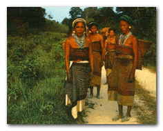
The literacy rate is estimated at 68.3%.[31] The city population is composed of people from virtually every region of Bangladesh. The long-standing inhabitants of the old city are known as Dhakaia and have a distinctive dialect and culture. Between 15,000 to 20,000 of the Rohingya, Santal, Khasi, Garo, Chakma and Mandi tribal peoples reside in the city.[61] Dhaka also has a large population of Chinese, Korean, Indian, Burmese, and Nepali expatriates working in executive jobs in different industries.
Most residents of Dhaka speak Bangla, the national language. Many distinctive Bangla dialects and regional languages such as Chittagonian and Sylheti are also spoken by segments of the population. English is spoken by a large segment of the population, especially for business purposes. There is a minority Urdu-speaking population, who are descendants of displaced Muslims from Eastern India during 1947 and sought refuge in East Pakistan. The correct population is ambiguous; although official figures estimate at least 40,000 residents,[62] it is estimated that there are at least 300,000 Urdu-speakers in all of Bangladesh, mostly residing in refugee camps in Dhaka.[63][64]
Islam is the dominant religion of Dhaka's people, of about 90% of the city practicing the faith; with a majority belonging to the Sunni sect. There is also a small Shia sect, and an Ahmadiya community. Hinduism is the second-largest religion, with about 9%, and smaller communities practice Buddhism and Christianity, both of about .5% each.
Culture
See also: Culture of Bangladesh
The Tara Masjid (Star Mosque) is noted for its star-studded design
As the most populous city of Bangladesh, Dhaka has a vibrant cultural life. Annual celebrations for Independence Day (March 26), Language Martyrs' Day (February 21) and Victory Day (December 16) are prominently celebrated across the city. Dhaka's people congregate at the Shaheed Minar and the Jatiyo Smriti Soudho to remember the national heroes of the liberation war. These occasions are observed with public ceremonies and rallies in public grounds. Many schools and colleges organize fairs, festivals and concerts in which citizens from all levels of society participate.[65]
Pohela Baishakh, the Bengali New Year, falls annually on April 14 and is popularly celebrated across the city.[65] Large crowds of people gather on the streets of Shahbag, Ramna Park and the campus of the University of Dhaka for celebrations. The most popular dressing style for women are sarees or salwar kameez, while men usually prefer western clothing to the traditional lungi. The Muslim festivals of Eid ul-Fitr and Eid ul-Adha witness widespread celebrations across the whole city. For much of recent history, Dhaka was characterised by roadside markets and small shops that sold a wide variety of goods.[66] Recent years have seen the widespread construction of shopping malls, multiplexes, hotels and restaurants attracting Dhaka's growing middle-class and wealthy residents.[67] Along with Bangladeshi cuisine and South Asian variants, a large variety of Western and Chinese cuisine is served at numerous restaurants and eateries.[47] Though restaurants offering multinational cuisine and fastfood chains like KFC, Pizza Hut, Baskin Robbins, A&W, Chili's, have opened up in the city but unique Dhakai delicacies like Glassey, Hajir Biriani(Haji's Biriani), Fakhruddin Biriani, Mama Halim, Borhani etc. are still very popular amongst Dhakaiyas. These delicacies are even offered to state guests. Dhakai Bakarkhani is the traditional food/snack of the people of old Dhaka. It is famous for its quality and taste and it was highly praised by the Royal court of the Mughal Empire in Delhi.[68]
Despite the growing popularity of music groups and rock bands, traditional folk music remains widely popular.[69] The works of the national poet Kazi Nazrul Islam and national anthem writer Rabindranath Tagore have a widespread following across Dhaka.[70] The Baily Road area is known as Natak Para (Theater Neighborhood) which is the center of Dhaka's thriving theater movement.[71] Indian and Western music and films are popular with large segments of Dhaka's population.[72] This area is also credited for the revival of the Jamdani due to the many local saree stores selling and promoting these locally hand-made age old traditional Bengali sarees. Jamdanis are 100% hand weaved and originate from the Persian and Mughal era. Jamdanis are produced by a traditional high quality cottage industry, which is slowly dying out due to the slow production process. A single medium range Jamdani saree may take as long as 3 months to complete.[73]
Pohela Baishakh (Bangla New Year) celebration in Ramna park.

Bangladesh Betar is the state-run primary provider of radio services, and broadcasts a variety of programming in Bangla and English. In recent years many private radio networks, especially FM radio services, have been established in the city such as Radio Foorti FM 88.0, Radio Today FM 89.6, Radio Amar FM 101.6 and ABC Radio FM 89.2. Bangladesh Television is the state-run broadcasting network that provides a wide variety of programmes in Bangla and English. Cable and satellite networks such as Ekushey Television, Channel I, ATN Bangla, RTV, NTV and STAR TV are amongst the most popular channels. The main offices of most publishing houses in Bangladesh are based in Dhaka. The Prothom Alo and The Daily Ittefaq are the most popular amongst the large number of Bangla language dailies, periodicals and other publications in the city. The Daily Star and The Independent are the major English dailies published. Although cellular phones are gaining popularity, less than 10% of households have telephone access.
Transport
Famous rickshawref name="Rickshaws2"> Lawson, Alastair (2002-05-10). "Dhaka's beleaguered rickshaw wallahs". BBC News. Retrieved 2008-12-17.</ref>[75][76] Approximately 400,000 rickshaws run each day.[77]
A BRTC Volvo double-decker bus in Dhaka
Cycle rickshaws and auto rickshaws are the main mode of transport, with close to 400,000 rickshaws running each day – the largest number for any city in the world.[47][49] However, only about 85,000 rickshaws are licensed by the city government.[48][78] Relatively low-cost and non-polluting cycle rickshaws nevertheless cause traffic congestion and have been banned from many parts of the city. Public buses are operated by the state-run Bangladesh Road Transport Corporation (BRTC) and by private companies and operators. Scooters, taxis and privately owned automobiles are increasingly becoming popular with the city's growing middle class. The government has overseen the replacement of two-stroke engine taxis with "Green taxis" locally called CNG, which run on compressed natural gas.[79]
Dhaka has 1,868 kilometers (1,161 mi) of paved roads.[80] It is connected to the other parts of the country through strong highway and railway links. Highway links to the Indian cities of Kolkata and Agartala have been established by the BRTC which also runs regular bus services to those cities from Dhaka.[81]
The Kamalapur Railway Station, Airport (Biman Bandar) Railway Station and the Cantonment Railway Station are the main railway stations providing trains on suburban & national routes operated by the state-run Bangladesh Railway.[82] Bangladesh Railway also runs a regular train service between Dhaka and Kolkata.
The Sadarghat Port on the banks of the Buriganga River serves the transportation of goods and passengers upriver and to other ports in Bangladesh.[83]
The Shahjalal International Airport, located 15 km north of Dhaka city center, is the largest and busiest airport in the nation.[84] It handles 52% of the country's international and domestic arrivals and departures. Domestic service flies to Chittagong, Sylhet, Cox's Bazar, Jessore, Barisal, Saidpur and international services fly to major cities in Asia, the Middle East, North Africa and western Europe.
Education
Curzon Hall of the University of Dhaka. The university served as the prime centre for political activism amongst the youth and intellectuals during the Bengali freedom struggle
Dhaka has the largest number of schools, colleges and universities of any Bangladeshi city. The education system is divided into 4 levels: Primary (from grades 1 to 5), Secondary (from grades 6 to 10), Higher Secondary (from grades 11 to 12) and tertiary.[85] The five years of lower secondary education concludes with a Secondary School Certificate (SSC) Examination. Students who pass this examination proceed to two years of Higher Secondary or intermediate training, which culminate in a Higher Secondary Certificate (HSC) Examination.[85] Education is mainly offered in Bangla, but English is also commonly taught and used. A large number of Muslim families send their children to attend part-time courses or even to pursue full-time religious education, which is imparted in Bangla and Arabic in madrasahs.
here are 52 universities in Dhaka. The Dhaka College is the oldest institution of higher education in the city and amongst the earliest established in British India, founded in 1840. Since independence, Dhaka has seen the establishment of a large number of public and private colleges and universities that offer undergraduate and graduate degrees as well as a variety of doctoral programs.[86] The University of Dhaka is the largest public university[87] in the nation with more than 30,000 students and 1,300 faculty staff. The university has 18 research centers and 70 departments, faculties and institutes.[88] Eminent seats of higher education include the Jahangirnagar University and the Bangladesh University of Engineering and Technology (BUET). The Dhaka Medical College and the Sir Salimullah Medical College are amongst the largest and most respected medical schools in the nation.[89] Dhaka's college campuses are often hotbeds of political conflicts.[90] Protests and strikes, and violence amongst police, students and political groups frequently disrupt public university campuses
Media and communications
Postal service: The Bangladeshi postal service, commonly known as Bangladesh Post Office, headquartered in Dhaka, is responsible for providing postal service in throughout the country.[93]
Print and publication: Dhaka is home to the major newspapers and publications of Bangladesh's outspoken, diverse and privately owned press.[94] Some of the major publications based in Dhaka include the country's oldest newspapers Daily Ittefaq, Daily Azad, Manabzamin, Daily Janakantha,[95] also Daily Prothom Alo, Amar Desh and so on. The major English newspapers include The Daily Star,[96] The Independent, New Age and The Financial Express. Popular weekly newapapers and magazines include Holiday, The Star, Dhaka Courier, Anandaloke and Saptahik 2000. Other major magazines and publications include Forum, Ice Today, The Executive Times, Energy Bangla, Annanya and Computer Jagat.
News agency: The national news agency of Bangladesh is Bangladesh Sangbad Sangstha.[97] BSS handles national news including the activities of the government, diplomatic affairs, socio-political happenings, economy, finance, sports, culture, law and parliamentary affairs. Newspapers throughout the country, radio and television authorities, and some government agencies subscribe to the news service of BSS.[98] The first privately-owned news agency in Bangladesh Eastern News Agency was established in Dhaka in March 1970. Another private sector news agency United News of Bangladesh was launched in 1988 in Dhaka with the Associated Press (AP) of the United States as its principal anchor.
TV and radio: The state-run television BTV is headquartered in Rampura, Dhaka.[99] Other private sector television channel include (Diganta TV),Bangla Vision,RTV, ATN Bangla, Channel I, NTV, Ekushey Television, Banglavision etc. which are also based in Dhaka. The state-owned radio broadcasting organisation of Bangladesh, known as Bangladesh Betar[100] is located at Sher-e-Bangla Nagor in Dhaka. Other private radio stations like Radio Foorti, Radio Today, Radio Amar etc. are also headquartered in Dhaka. Recently, a 24-hour news station named "ATN News" has emerged on screens.among the private university north south, brac,east west are notable.
Sports
A cricket match between Bangladesh & India at Sher-e-Bangla Cricket Stadium
For more details on this topic, see Sports in Bangladesh.
Cricket and football are the two most popular sports in Dhaka and across the nation.[101] Teams are fielded in intra-city and national competitions by a large number of schools, colleges and private entities. The Mohammedan Sports Club and Abahani are two of the most famous football and cricket teams, maintaining a fierce rivalry.[102]
Dhaka has the distinction of having hosted the first official test cricket match of the Pakistan cricket team in 1954 against India.[103] The Bangabandhu National Stadium was formerly the main venue for domestic and international cricket matches, but now exclusively hosts football matches.[103] It is a potential host for the opening ceremony of the 2011 Cricket World Cup as well as host to 8 matches to be played in Bangladesh (6 in Dhaka and 2 in Chittagong) .[104] The Bangladesh Sports Control Board, responsible for promoting sports activities across the nation is based in Dhaka. Dhaka also has stadiums largely used for domestic events such as the Sher-e-Bangla Mirpur Stadium (in Mirpur), the Dhanmondi Cricket Stadium and the Outer Stadium Ground.[105] The Dhaka University Ground hosts many intercollegiate tournaments.[106]
Dhaka also contains large fields for youngsters to play, such as the Youth Club in Gulshan.
[edit]
Sister cities
A cricket match between Bangladesh & India at Sher-e-Bangla Cricket Stadium
For more details on this topic, see Sports in Bangladesh.
Cricket and football are the two most popular sports in Dhaka and across the nation.[101] Teams are fielded in intra-city and national competitions by a large number of schools, colleges and private entities. The Mohammedan Sports Club and Abahani are two of the most famous football and cricket teams, maintaining a fierce rivalry.[102]

Dhaka has the distinction of having hosted the first official test cricket match of the Pakistan cricket team in 1954 against India.[103] The Bangabandhu National Stadium was formerly the main venue for domestic and international cricket matches, but now exclusively hosts football matches.[103] It is a potential host for the opening ceremony of the 2011 Cricket World Cup as well as host to 8 matches to be played in Bangladesh (6 in Dhaka and 2 in Chittagong) .[104] The Bangladesh Sports Control Board, responsible for promoting sports activities across the nation is based in Dhaka. Dhaka also has stadiums largely used for domestic events such as the Sher-e-Bangla Mirpur Stadium (in Mirpur), the Dhanmondi Cricket Stadium and the Outer Stadium Ground.[105] The Dhaka University Ground hosts many intercollegiate tournaments.[106]
Dhaka also contains large fields for youngsters to play, such as the Youth Club in Gulshan.