Friday 16 March 2012

water softeninig in bd

You can combat hard water in various ways, including filtering it by distillation or reverse osmosis, adding a packaged chemical softener such as powdered borax or washing soda (sodium carbonate), or running it through a water softener.

Filtration in sink taps and refrigerator water dispensers improves water's taste, but its steep price tag makes it impractical as a household solution. Packaged chemicals soften water in small batches, such as washing machine loads, but render the water undrinkable, take a toll on clothes, and, in some cases, contain phosphates that harm the earth

nuvo h2o

Descaling offers an alternative to water softening. Whereas a water softener removes the problem (minerals in the water), a descaler addresses the damage caused by the problem (scale buildup). You will sometimes see ads for "salt-free water softeners," which are actually descalers, or for magnetic water softeners, which remain unproven and don't change the chemical composition of water, so buyer beware ith all this in mind, it's clear why water softeners are so popular: They remain the least costly and most effective way to rid your water of troublesome minerals.

Friday 20 May 2011

Sylhet Division


Sylhet Division (Bengali: সিলেট বিভাগ, pronounced Sileṭ Bibhag), also known as Greater Sylhet or Sylhet region,[2] is the northeastern division of Bangladesh, named after its main city, Sylhet. It is bounded by Meghalaya State of India on the north, Tripura State on the south, Assam State of India on the east and Dhaka division on the west and Chittagong division on the southwest.
One of the most picturesque and archeologically rich regions in South Asia, is the Sylhet Division. Its bourgeoning economy has become a part of the attractions of the region, as landscapes are filled with fragrant orange and pineapple gardens and breathtaking tea plantations. Many Sylhet community members have found work and residence abroad, particularly in the United Kingdom and have been using remittances to fund projects and industries within the Sylhet Division, allowing the export industry and foreign investment sectors to grow.


Districts of Sylhet Division


1.Sylhet

2. Maulvi bazar 

3.Sunamganj

4.Habiganj


History


he 14th century marked the beginning of Islamic influence in Sylhet.A Muslim saint, Hazrat Shaikh al Mushaek Jalal Uddin, popularly known as Shah Jalal, arrived in Sylhet in 1303 CE from Mecca via Delhi with 360 Sufi saints and army generals such as Sikander Ghazi, Syed Nasiruddin and Khwaja Burhanuddin Qahtan defeating Govinda of Gaur. Sikander Ghazi was the direct nephew of Sultan Feroze Shah of Delhi. Under the spiritual leadership of Hazrat Shah Jalal and his 360 companions the local pagans were brought under control and they began to spread Islam. He died in Sylhet in or around the year 1350 CE. His shrine is located inside the parameter of the mosque complex known as Dargah-e-Shah Jalal. Even today Shah Jalal remains revered; visitors arrive from all over Bangladesh and beyond to pay homage. Saint Shah Jalal and his companions were responsible for the conversion of most of the populace from their earlier beliefs in Hinduism, Buddhism and Paganism to Islam. Shortly, thereafter, Sylhet became a centre of Islam in Bengal. In the official documents and historical papers, Sylhet was often referred to as Jalalabad during the era of the Muslim rule. In the late 18th century, the British East India Company became interested in Sylhet and saw it as an area of strategic importance in the war against Burma. Sylhet gradually was absorbed into British control and administration and was governed as a part of Bengal. After the British administrative reorganization of India, Sylhet was eventually incorporated into Assam. It remained a part of Assam for the rest of the era of British rule. In 1947, following a referendum, almost all of erstwhile Sylhet became a part of East Pakistan, barring the Karimganj subdivision which was incorporated into the new Indian state of Assam. The referendum was held on 3 July 1947, there were a total of 546,815 votes cast on 239 polling stations, a majority of 43.8 per cent voted in favour of East Bengal. There were protests regarding bogus votes.However, the referendum was acknowledged by Article 3 of the India Independence Act of 18 July 1947. In 1971, Sylhet became part of the newly formed independent country of Bangladesh.
The Sylhet region has a "friendship link" with the city of St Albans, in the United Kingdom. The link was established in 1988 when the District council supported a housing project in Sylhet as part of the International Year of Shelter for the Homeless. Sylhet was chosen because it is the area of origin for the largest ethnic minority group in St Albans. The majority of British Banngladeshis are of Sylheti ethnic origin


.

Civic Administration

In 1995, Sylhet was declared the 6th division of the country. Prior to that it was part of the Chittagong Division. The Sylhet Division is subdivided into four districts (zillah): Habiganj, Maulvibazar, Sunamganj and Sylhet. Further, the Sylhet Division contains 35 sub-districts (upazila/thana), 323 union parishad, 10,185 villages and 14 municipalities. Population: approximately 10 million, which is less than 7% of the total population of Bangladesh.

Culture

Shaheed Minar replica at Srimongol
Sylheti attachment to their regional identity also continues in the efforts of many Sylhetis to keep marital relationships within the same regional, cultural, social and religious background. Sylheti people are considered as a distinct ethnic group in Bangladesh; They are also generally more family orientated, follow and support Sylheti community culture, and are more conformist Muslims. These tendencies have led to some rivalry between non-Sylhetis and Sylhetis, due to differences of customs.
Marriages are practiced in a traditional Muslim style, with henna ritual (mehendi), and prayers. Sylheti marriages often include contracts of marriage outlining both the rights and obligations of both partners. Marriages in Sylhet often take place with partners in the United Kingdom and the US.
Given its unique cultural and economic development, and linguistic differences (Greater Sylhet region was a part of Assam and Surma Valley State for about 100 years during the British Raj in comparison to the rest of Bangladesh), and given that Sylhet has, for much of its recent history, been a region of a larger entity.As so many Sylhetis are resident abroad, Sylhet has a major flow of foreign currency from non-resident Bangladeshis[citation needed].


Economy

The area around Sylhet is a traditional tea growing area. The Surma Valley is covered with terraces of tea gardens and lush green tropical forests. Srimangal is known as the tea capital of Bangladesh and for miles around one can see the tea gardens on the hill slopes.
The area has over 150 tea gardens, including three of the largest tea gardens in the world both in terms of area and production. Nearly 300,000 workers, of which over 75% are women, are employed on the tea estates. Employers prefer to engage women for plucking tea leaves since they do a better job and are paid less than the men. Unfortunately recent drought has killed nearly a tenth of the tea shrubs.
The gardens are relics from the days of the British Raj. The plantations were started by the British and the managers still live in white timber homes as they did in those days. The bungalows stand on huge lawns and the service and lifestyle is pretty much unchanged.
A relatively new area that has come under tea cultivation is the sub-Himalayan terrain of Panchagarh. The soil and climate is highly favorable for growing tea here. In fact this area is contiguous with Assam and Bengal in India, where tea has been grown for decades. Beginning with only 300 acres (1.2 km2) of land in 2000, the cash crop is now being cultivated on over 3,500 acres (14 km2) in Tentulia, Sadar and Atoari upazilas of Panchagarh.
The humus content in the soil here is more than in the traditional tea-growing areas of Sylhet. The tea produced in Panchagarh is supposedly much better in quality than that of Sylhet. Several nurseries have been set up in Panchagarh and Thakurgaon to supply saplings to the tea gardens. Bangladesh exports tea to Pakistan and Russia.
There are large numbers of investments and businesses in the city and in large towns funded by Sylhetis living abroad, in particular by British Bangladeshis, over 95 percent of whom come from this Sylhet region.[18] The Bangladesh government has set up a special Export Processing Zone (EPZ) in Sylhet, in order to attract foreign investors, mainly from the UK


Religion and Faith


Sylhet is a holy place for both Muslim and Hindus. It is a land of 360 awliyas. Notable Hindu saint Chaitanya Mahaprabhu visited his maternal and paternal family homes in Burunga (Balaganj), Dhaka Dakkhin (Gulapganaj) and Habiganj in Sylhet Division. Famous religious places include, the shrines of Hazrat Shah Jalal (R), Hazrat Shah Farhan (popularly known as Shah Paran (R), Hazrat Shah Kamal Qattani (R) in Shaharpara,Hazrat Sayyed Zakir Shah Fatimi (R) in Turuk Khola of South Surma and Sipahsalar Syed Nasiruddin (R) in Habiganj for Muslims. Hindu temples like Shree Chaitanya Dev Mandir, Kali Mandir of Jainpur, Shakti Piths temple of Kirit Devi Kamala, Bagala Matar Mandir of Habiganj and Kalibari of Jaintiapur are known throughout the Indian Subcontinent.[19]
Followers of Different religions are: Muslim 81.16%, Hindu 17.80%, Christian 0.06%, Buddhist 0.02% and others 0.96%.


Friday 6 May 2011

Chittagong divisiom


Chittagong Division. the second most developed division of the four in the country, shares its northern border with Assam - the tea-growing area - and, to the east, with Burma. It has the distinction of being Bangladesh's only hilly region with hills ranging from about 800 feet (242 meters) in the north to about 200 feet (60 meters) in the southern ranges. The narrow coastal strip is crowded in by hills to the east, which is the only region where the land is not fragmented by river deltas.

In the northeastern district of Comilla, there are archaeological sites second only in importance to those at Mahasthan. If you are driving to Chittagong and Cox's Bazaar, the Mainamati sites are about 60 miles (100 km) southeast of Dhaka. Although there is an extensive range of over 50 very important Buddhist sites uncovered along the north-south Lalmai-Mainamati range of hills, many of them are located in a military zone. making access to them almost impossible. The Mainamati Archaeological Museum and some of the accessible sites are about six miles ( 10 km) west of Comilla town. Mainamati echoes the memory of the celebrated King Govinda Chandra's mother who was so popular in local legends and folk ballads, whilst lanai or 'red hill' refers to the red color of the soil. Most of the sites contain various types of Buddhist structures dating from between the eighth and 12th centuries, consisting of monasteries, temples and stupas, which have produced a rich collection of archaeological remains.

About three miles (five km) north of Salban Vihara, is a unique group of Buddhist brick monuments known as the Kutila Mura. They consist of three stupas, possibly representing the Buddhist trinity or three jewels Buddha, Dharma and Sangha. The Charpatra Mura is about two miles to the northwest, and several of its important finds can be seen in the museum. The largest of the ridge sites, the Ananda Vihara, another Buddhist monastery, is only about a half-mile away. It probably derives its name from Anandadeva, the third and greatest ruler of the early Deva Dynasty. All these sites are out of bounds unless prior permission is received from the army.


Fortunately, the museum is well stocked with the various finds made at these sites. There is a large collection of bronze images/scenes of the Buddha, Bodhisattva and Tara. There is also an interesting solid cast bronze stupa measuring 10 inches high, giving an interesting insight into the original shapes of the ruined stupas.
Sadly, no terra-cotta plaques are to be found in situ on the Salban Vihara. However, several were collected during the excavations and are on display. They are fine examples of an animated rural art form with a host of different subjects ranging from birds and animals to humans and semidivine beings depicting the local folklore and mythology. This ensemble of Buddhist sites refelects an unmistakably high standard al material civilization achieved by the people of southeast Bengal between the seventh and 12th centuries.

Sylhet is in the northern part of Chittagong Division, located in a gentle sloping upland valley between the Khasia, Jaintia and Tripura hills, bordering on Assam. Gentle slopes, rich light soil, a congenial climate and abundant rainfall have made Sylhet one of the largest tea-producing areas in the world. These conditions have also provided rich tropical forests where big game - tiger, panther and wild boar - abound. Tribal life is strong and folk dancing, like the famous Manipuri dance, is still performed by the local tribes


The busy port of Chittagong has long associations with seafaring traders and is strongly linked with the colorful spice trade between Europe and the East. Today, it is a large and thriving city set amid beautiful natural surroundings, studded with greenclad knolls, coconut palms, mosques and minarets against a background of the Bay of Bengal. The city is located on the Karnaphuli River. As a seaport it has always been a great center for trade, especially after the Portuguese overran the city in the 16th century. There is also a strong British influence in some of the colonial administrative buildings. The Circuit House is one of the most attractive buildings left by the British and has been the scene of a number of historic and bloody events, the last being the assassination of President Ziaur Rahman on May 30, 1981.


The most notable of the numerous mosques around Chittagong are the Jami Mosque, built by Shaista Khan's son to commemorate the reconquest of Chittagong in 1666, and the Qadam Mubarak Mosque in the Rahmatganj area of Chittagong, built In 1719 by Muhammad Yasin and one of the few mosques of the area that retains its original features.


The lush tropical vegetation and unique concentration of tribal cultures has made the Chittagong Hill Tracts a potentially fascinating tourist destination in Bangladesh. Ironically, it is the most troubled region in the country and has therefore been made a restricted area, permitting tourists to visit only Rangamati and Kaptai.

Rangamati, the headquarters of the Chittagong Hill Tracts, is a favorite holiday resort because of its location on an isthmus projecting into Kaptai Lake. You can enjoy swimming, boating, sunbathing and exploring the small islands off the peninsulas. Each year in mid-April there is a colorful Buddhist water festival. For those interested in some ethnic shopping, the tribal woven fabrics are of excellent quality with simple but bright and beautiful patterns.


There are innumerable boat trips that you can make on the 170-square-mile (426 square-km) lake, the most feasible being to Kaptai, where the site for a hydroelectric project is located.

About three miles (five km) beyond Kaptai is Chitmorong, a Buddhist village where one of the many Buddhist monasteries exhibits a strong Burrmese influence.


Perhaps the best-known tourist destination in Bangladesh is Cox's Bazaar and the beaches around it. Inani Beach, south of Cox's, can claim to be the longest in the world. The town derives its name from Captain Hiram Cox, who in 1798 was commissioned to settle the region with Arkanese immigrants fleeing from Burma. Cox's Bazaar developed with the influence of the new refugee Magh settlers who erected a series of picturesque white plastered pagodas or stupas on the low hilltops above the town. In true Burmese fashion, they also built the 19th century khyangs or monasteries, which can be seen at Ramu and in Cox's Bazaar itself.


The Bara Khyang of Lama Bazaar, near Ramu, consists of three separate buildings, one of which houses interesting reliquaries and Burmese handicratts as well as the largest bronze statue of the Buddha in Bangladesh, cast at the end of the last century. These buildings characterize an imported style typical of the buildings along the Burmese border - timber framed with multi-tiered pitched roofs and extremely decorative fretted carvings. The interiors are generally simple spaces with a forest of columns supporting the complicated roofs above.


There is a similar compound in Cox's Bazaar known as the Aggameda Khyang, which nestles at the foot of a hill. The main prayer hall is raised off the ground on a series of round columns. Unlike at Lama Bazaar. there is an active Buddhist community of monks performing their daily worship. Scattered around the compound are a fine collection of Buddhist images/scenes, mostly of Burmese origin.

Later, the region was the favorite haunt of Mogh pirates and brigands who, with the Portuguese, used to ravage the Bay of Bengal in the 17th century. The Moghs have remained, maintaining their tribal ways through their handicrafts, their hand-made cheroots and their decorative shell work. In Cox's Bazaar it is still possible to see the shy and unassuming Mogh craftsmen at work.
To get away from it all there are the beaches, usually fairly well-populated with local tourists for the first few hundred yards. But beyond this are more than 70 miles (112 km) of silver-gold sand and surf enough to satisfy even the most incurable beach bum.


Thursday 5 May 2011

Barishal


Barisal (Town) consists of 30 wards and 50 mahallas. The area of the town is 16.37 sq km. Barisal municipality was established in 1957 and was turned into a city corporation in 2000. It has a population of 202242; male 53.28%, female 46.72%. Literacy rate among the town people is 65%. The town has three dakbungalows and six police outposts.

Administration Bakerganj disrict was established in 1797. Later on it was renamed as Barisal district. Barisal was declared a division on 1 January, 1993. The district consists of one city corporation, five municipalities, 66 wards, 111 mahallas, 10 upazilas, 86 union parishads, 1147 mouzas and 1175 villages.

Archaeological heritage and relics Rammohan Samadhi Mandir, Sujabad Kella, Sangram Kella, Sharkal Fort, Girja Mahalla, Bell's Park, Ebadullah Mosque, Kasai Mosque, Oxford Church, Shankar Math, Kali Bari of Mukunda Das, Joint Mosque at Bhatikhana, aswini kumar town hall, Charkella, durgasagar Dighi, one domed Mosque (Kasba), brass image of Manasa weighing three maunds (Char Bania Bari).
Historical events Ancient name of Barisal was chandradvipa. The capital of this kingdom was at Bakla. The founder of the kingdom was Danuj Madhav or Danuj Mardhan Dev.
Marks of the War of Liberation Mass killing site 3, mass grave 2, sculpture 2, memorial 4.
Population 2330960; male 49.99%, female 50.01%; Muslim 86.19%; Hindu 13.10%, Christian 0.63% and others 0.08%.
Literacy and educational institutions Average literacy 42.9%; male 47.9%, female 37.9%. Educational institutions: university college 1, polytechnic institute 1, medical college 1, physical education college 1, teacher's training college 2, nursing institute 1, cadet college 1, government college 7, non-government college 39, government high school 4, non-government high school 312, junior school 33, government primary school 1204, non-government primary school 412, madrasa 698, cadet school 5, kindergarten 11, music school 2. Noted educational institutions: sher-e-bangla medical college and Hospital, b m college (1889), Oxford Mission High School, Barisal Zila School, Banaripara Union Institution (1889), Pinglakathi Government Model Primary School (1882), Bheduriarchar Government Primary School (1892).
Religious institutions Mosque 3941, temple 805, church 44, tomb 5.
Cultural organisations Club 269, public library 12, cinema hall 14, theatre group 18, jatra party 2, circus party 4, literary society 6, woman's organisation 20, shilpakala academy 1, playground 133, Nazrul Academy 1.
Locally published newspapers and periodicals Dailies: Shahnama, Probashi, Gram Samachar, Ajker Barta, Rupantar Sathi, Saikot Barta, Darpan, Dipanchal, Ajker Kantha; periodicals: weekly Lokabani, Bakerganj Parikrama, Chirantan Bangla, Upakul, periodicals Paira, the River, Etibriti, Khadem, Chirantan Bangla, Upakul, Samachar, Gournadi Parikrama; extinct; Barisal Bartabaha (1870), Hitasadhini (1871), Banglar Ranjika (1873), Kashipur Nibasi (1881), Swadesh (1885), Bharat Hitoishi (1882), Barisal Hiroishi (1885), Bikash (1900), Sahayogi (1885), Praddip (1927), Tarun (1923), Pathik (1925), Bahumihir (1926), Protiva Tangim (1949), Parimal Bahini (1859).
Main occupations Agriculture 35.28%, agricultural labourer 18.76%, wage labourer 4.16%, commerce 13.89%, service 10.64%, fishing 3.45%, construction 1.25%, transport 1.72% and others 10.85%.
Land use Cultivable land 178601 hectares; fallow land 5785.4 hectares; single crop 37.68%, double crop 48.80% and treble crop land 13.52%.
Land value Market value of land of the first grade is approximately 10000 per 0.01 hectare.
Main crops Paddy, jute, oil seed, betel leaf, onion, sugarcane.
Extinct or nearly extinct crops Aus paddy, china.
Main fruits Mango, jackfuit, banana, coconut, litchi, betel nut, black berry, guava, amra.
Dairies, poultries, fisheries Poultry 791, dairy 126, fishery 712, hatchery 20.
Communication facilities Roads: pucca 362.5 km, semi pucca road 378 km, mud road 3133 km; waterways 355 nautical miles; airport 1.
Traditional transport Palanquin, horse carriage, bullock cart, Gaina boat. These means of transport are either extinct or nearly extinct.
Manufactories Jute mill, textile mill, pharmaceutical industry, biscuit factory, flour mill, oil mill, ice factory, rice mill.
Cottage industries Weaving, bamboo works, goldsmith, blacksmith, potteries, wood work, tailoring, welding, bidi.
Hats, bazars and fairs Total number of hats and bazars are 272; fair 32, most noted of which are Aratdari Hat, Chawkbazar, Patar Hat, Ulania Hat, Lakhutia Bazar, Torki Bazar, Kasba Cattle Market, Shaheber Hat, Chawkbazar, Suryamonir Mela, Kodaldoa Baruni Mela.
Main exports Paddy, fish, shital pati, betel leaf, guava, coconut, betel nut and amra.
NGO activities Operationally important NGOs are brac, CARE, asa, caritas, proshika, grameen bank, BDS.
Health centres Medical college hospital, 1, private hospital 7, upazila health complex 11, private clinic 6, union health and family planning centre 75, family welfare centre 37, satellite clinic 32.

Monday 2 May 2011

Dhaka the capital of Bangladesh

Dhaka (Bangla: ঢাকা, pronounced IPA: [ˈɖʱaka]; formerly known as Dacca, and Jahangirnagar, during Mughal era), is the capital of Bangladesh and the principal city of Dhaka Division. Dhaka is a megacity and one of the major cities of South Asia. Located on the banks of the Buriganga River, Dhaka, along with its metropolitan area, has a population of over 12 million, making it the largest city in Bangladesh.[2] It is the 9th largest city in the world[4] and also among the most densely populated cities in the world. Dhaka is known as the City of Mosques[5] and renowned for producing the world's finest muslin. Dhaka is also known as the Rickshaw Capital of the World. Approximately 400,000 cycle rickshaws run each day.[6] Today it serves as one of the prime centers for culture, education and business in the region.

Under Mughal rule in the 17th century, the city was known as Jahangir Nagar. It was a provincial capital and a center of the worldwide muslin trade. The modern city, however, was developed chiefly under British rule in the 19th century, and became the second-largest city in Bengal after Calcutta (presently Kolkata). After the Partition of Bengal in 1905, Dhaka became the capital of the new province of Eastern Bengal and Assam but lost its status as a provincial capital again after the partition was annulled in 1911. After the partition of India in 1947, Dhaka became the administrative capital of East Pakistan, and later, in 1971, the capital of an independent Bangladesh. During the intervening period, the city witnessed widespread turmoil; this included many impositions of martial law, the declaration of Bangladesh's independence, military suppression, devastation during war, and natural calamities.

Modern Dhaka is the center of political, cultural and economic life in Bangladesh.[7] Although its urban infrastructure is the most developed in the country, Dhaka suffers from urban problems such as pollution, congestion, and lack of adequate services due to the rising population. In recent decades, Dhaka has seen modernization of transport, communications and public works. The city is attracting large foreign investments and greater volumes of commerce and trade. It is also experiencing an increasing influx of people from across the nation, this has made Dhaka the fastest growing city in the world.[8][9]


History


Lalbagh Fort, constructed in the mid 17th century by Prince Mohammed Azam Shah, son of the Emperor Aurangzeb, and the Fort contains the tomb of Bibi Pari, daughter of Shaista Khan

The existence of a settlement in the area that is now Dhaka dates from the 7th century. The city area was ruled by the Buddhist kingdom of Kamarupa and the Pala Empire before passing to the control of the Hindu Sena dynasty in the 9th century.[10] The name of the city may have derived after the establishment of the Goddess Dhakeshwari's temple by Ballal Sena in the 12th century.[11] Dhaka and its surrounding area was identified as Bengalla around that period. The town itself consisted of a few market centers like Lakshmi Bazar, Shankhari Bazar, Tanti Bazar, Patuatuli, Kumartuli, Bania Nagar and Goal Nagar. After the Sena Empire, Dhaka was successively ruled by the Sultanate of Bengal as well as interruption of governors from the Delhi Sultanate before being taken over by the Mughals in 1608.[12]


The development of townships and housing has resulted into a significant growth in population came as the city was proclaimed the capital (Rajmahal) of Bengal under Mughal rule in 1608.[13][14][15] Mughal subahdar Islam Khan was the first administrator of the city.[16] Khan named the town "Jahangir Nagar" (জাহাঙ্গীর নগর; City of Jahangir) in honor of the Mughal emperor Jahangir, although this name was dropped soon after Jahangir's death. The main expansion of the city took place under Mughal general Shaista Khan.[14][15] The city then measured 19 by 13 kilometers (12 by 8 mi), with a population of nearly one million people.[17] British East India Company in 1765 gained right to collect revenue (Diwani right) and later took over governing in 1793 when Nawabs of Bengal were forced to abdicate all their authority over Bengal, Bihar & Orissa & the city passed on to total British control.The city's population shrank dramatically during this period as the prominence of Calcutta rose,[18] but substantive development and modernisation eventually followed. A modern civic water supply system was introduced in 1874 and electricity supply launched in 1878.[19][20] The Dhaka Cantonment was established near the city, serving as a base for British and Bengali soldiers.[15]

uring the abortive Partition of Bengal in 1905, Dhaka was declared to be the capital of the newly established state of East Bengal and Assam, but Bengal was reunited in 1911.[13][14][15] Following the Partition of India in 1947, Dhaka became the capital of East Pakistan. The city witnessed major communal violence following the partition of India.[15] A large proportion of the city's Hindu population departed for India, while the city received a large influx of Muslims. As the center of regional politics, however, Dhaka saw an increasing number of political strikes and incidents of violence.[15] The adoption of Urdu as the sole official language of Pakistan led to protest marches involving large crowds. Known as the Bengali Language Movement, the protests resulted in Pakistani police firing which killed a number of peaceful student demonstrators.[21] Throughout the 1950s and 1960s, Dhaka remained a hotbed of political activity, and the demands for autonomy for the Bengali population gradually gained momentum.[22]

The 1970 Bhola cyclone devastated much of the region, killing an estimated 500,000 people.[23] More than half the city was flooded and millions of people were marooned.[24] With public anger growing against ethnic discrimination and poor cyclone relief efforts from the central government, Bengali politician Sheikh Mujibur Rahman held a nationalist gathering on March 7, 1971 at the Race Course Ground.[15][21] An estimated one million people attended the gathering, leading to the March 26 declaration of Bangladesh's independence.[21] In response, the Pakistan Army launched Operation Searchlight, which led to the arrests, torture and killing of thousands of people.[25] After nine months of bloody battle with Indian Army and Mitra Bahini, the Pakistani Army surrendered to the Indian Army on December 16 marking the end of the independence war of Bangladesh.[26] As the nation's capital, Dhaka saw a rapid and massive growth of the city population in the post-independence period, as migrant workers from rural areas across Bangladesh moved to the city.[27] The growth of commerce and industry along with the city's population has created further challenges to services and infrastructure.[28] A real estate boom has followed the expansion of city limits and the development of new settlements such as Uttara, Mohammadpur, Bashundhara, Mirpur and Motijheel.[29]

Geography

Dhaka is located in central Bangladesh at 23°42′0″N 90°22′30″E, on the eastern banks of the Buriganga River. The city lies on the lower reaches of the Ganges Delta and covers a total area of 153.84 square kilometres (59.40 sq mi).[30] It consists of eight principal thanas –Lalbagh, Kotwali, Sutrapur, Ramna, Motijheel, Paltan, Dhanmondi, Mohammadpur, Tejgaon – and 16 auxiliary thanas – Gulshan, Mirpur, Pallabi, Shah Ali, Turaag, Sabujbagh, Dhaka Cantonment, Demra, Hazaribagh, Shyampur, Badda, Kafrul, Kamrangir char, Khilgaon and Uttara. In total the city has 130 wards and 725 mohallas.[31] Dhaka district has an area of 1463.60 square kilometers (565 sq mi); and is bounded by the districts of Gazipur, Tangail, Munshiganj, Rajbari, Narayanganj, Manikganj.[31] Tropical vegetation and moist soils characterize the land, which is flat and close to sea level. This leaves Dhaka susceptible to flooding during the monsoon seasons owing to heavy rainfall and cyclones.[32]


Climate


Dhaka experiences a hot, wet and humid tropical climate. Under the Koppen climate classification, Dhaka has a tropical wet and dry climate. The city has a distinct monsoonal season, with an annual average temperature of 28 °C (82 °F) and monthly means varying between 20 °C (68 °F) in January and 32 °C (90 °F) in May.[33] Nearly 80% of the annual average rainfall of 1,854 millimeters (73 in) occurs between May and September.[33] Increasing air and water pollution emanating from traffic congestion and industrial waste are serious problems affecting public health and the quality of life in the city.[34] Water bodies and wetlands around Dhaka are facing destruction as these are being filled up to construct multi-storied buildings and other real estate developments. Coupled with pollution, such erosion of natural habitats threatens to destroy much of the regional biodiversity.[34][hide]


Civic administration


The Dhaka municipality was founded on August 1, 1864 and upgraded to "corporation" status in 1978.[35] The Dhaka City Corporation is a self-governing corporation which runs the affairs of the city. The incorporated area is divided into several wards, which have elected commissioners. The mayor of the city is elected by popular vote every five years, and the post is presently held by Sadeque Hossain Khoka.[36] The Dhaka Education Board is responsible for administering all public schools and most private schools with the exception of English-medium schools and madrassahs.[37][38] All madrassahs in Bangladesh are governed by a central board while English-medium schools are under separate educational and governance structures.[39]

Cresent lake at night

The Dhaka Metropolitan Police (DMP) was established in 1976 and has 6,000 personnel in 12 police stations.[40] With the rapid population growth of the city, the force has been raised to 23,000 personnel and the establishment of 33 police stations has been completed and the creation of another 18 police stations is underway.

The city is divided into 25 (i.e 2011) parliamentary constituencies. The two main political parties are the Awami League and the Bangladesh Nationalist Party. Ramna contains the Secretariat, which houses most of the government ministries. The Supreme Court of Bangladesh and the Dhaka High Court are located in the city. The Bangabhaban palace has served as the official residence of the Viceroy of India, the governor of East Pakistan and presently the President of Bangladesh.[41] The Jatiyo Sangshad Bhaban, designed by renowned architect Louis Kahn,[21] houses the unicameral national parliament. The Baitul Mukarram, developed with a design resembling the Kaaba of Mecca, is the national mosque.[42] Other historical monuments in the city include the Bara Katra palace, the Lalbagh Fort, the Hoseni Dalan and the Ahsan Manzil.[43]

To fight rising traffic congestion and population, the national government has recently implemented a policy for rapid urbanization of surrounding areas and beyond by the introduction of a ten year holiday on income tax for new construction of facilities and buildings outside Dhaka.[44] Aside from Chittagong, Dhaka has a water-borne sewage system, but this serves only 25% of the population while another 30% are served with septic tanks.[45] Only two-thirds of households in Dhaka are served by the city water supply system. More than 9.7 million tons of solid wastes are produced in Dhaka city each year. While private and government efforts have succeeded in collecting garbage city-wide and using it as manure, most solid wastes are often dumped untreated in nearby low-lying areas and water bodies.
 Economy
dhaka is the commercial heart of Bangladesh.[46] The city has a growing middle class population, driving the market for modern consumer and luxury goods.[14][47] The city has historically attracted a large number of migrant workers.[48] Hawkers, peddlers, small shops, rickshaw transport, roadside vendors and stalls employ a large segment of the population[48][49] — rickshaw-drivers alone number as many as 400,000.[50] Half the workforce is employed in household and unorganized labor, while about 800,000 work in the textile industry. Even so, unemployment remains high at 23%.[51] As of 2009, Dhaka's Gross Municipal Product (GMP) is registered at $81 billion.[52] With an annual growth rate of 6.2%, the GMP is projected to rise to $215 billion by 2025.[52] The annual per capita income of Dhaka is estimated at $500, with 48% of households living below the poverty line,[53] including a large segment of the population coming from the villages in search of employment,[47] with many surviving on less than $10 a day.[54]

Bangabandhu International Conference Centre

The main commercial areas of the city include Motijheel, New Market, Gulshan and Farmgate, while Tejgaon and Hazaribagh are the major industrial areas.[55] Bashundhara-Baridhara is a developing economic area that will include high-tech industries, corporations and a large shopping mall in about 5 years.[47] The Export Processing Zone in Dhaka was set up to encourage the export of garments, textiles and other goods. Dhaka has two EPZ's. They are home to 413 industries, which employ mostly women.[56] The Dhaka Stock Exchange is based in the city, as are most of the large multinationals including Citigroup, HSBC Bank Bangladesh, JPMorgan Chase, Standard Chartered Bank (Bangladesh), American Express, Chevron, Exxon Mobil, Total, British Petroleum, Unilever, Nestle, DHL Express, FedEx and British American Tobacco. Large local conglomerates such as Concord Group, Rangs Group, Beximco Group, Summit Group, Navana Group, Zaman Group of Industries and Rahimafrooz also have their corporate offices located in Dhaka. Microcredit also began here and the offices of the Nobel Prize winning Grameen Bank[57] and BRAC are based in Dhaka.[58] Urban developments have sparked a widespread construction boom; new high-rise buildings and skyscrapers have changed the city landscape.[47] Growth has been especially strong in the finance, banking, manufacturing, telecommunications and services sectors, while tourism, hotels and restaurants continue as important elements in the economy of Dhaka


Demographic


Animation showing urban growth in Dhaka, Bangladesh from 1972 to 2001. The animation starts with a global view over India using Terra-MODIS 30 km. true color data. The animation then zooms down to Terra-MODIS 1 km. data over Bangladesh, and dissolves into the December 28, 1972, Landsat-1-MSS data of Dhaka. Dhaka can then be seen growing to its present day size by first showing the February 13, 1989 Landsat-5-TM image which then dissolves into the final January 29, 2001 Landsat-7-ETM+ image.[59]

The population of Dhaka city (areas under the jurisdiction of the Dhaka city corporation) stands at approximately 7.0 million. The city, in combination with localities forming the wider metropolitan area, is home to an estimated 12.8 million as of 2008.[2] The population is growing by an estimated 4.2% per year, one of the highest rates amongst Asian cities.[48] The continuing growth reflects ongoing migration from rural areas to the Dhaka urban region, which accounted for 60% of the city's growth in the 1960s and 1970s. More recently, the city's population has also grown with the expansion of city boundaries, a process that added more than a million people to the city in the 1980s.[48] According to Far Eastern Economic Review, Dhaka will become a home of 25 million people by the year 2025.[60]

The literacy rate is estimated at 68.3%.[31] The city population is composed of people from virtually every region of Bangladesh. The long-standing inhabitants of the old city are known as Dhakaia and have a distinctive dialect and culture. Between 15,000 to 20,000 of the Rohingya, Santal, Khasi, Garo, Chakma and Mandi tribal peoples reside in the city.[61] Dhaka also has a large population of Chinese, Korean, Indian, Burmese, and Nepali expatriates working in executive jobs in different industries.

Most residents of Dhaka speak Bangla, the national language. Many distinctive Bangla dialects and regional languages such as Chittagonian and Sylheti are also spoken by segments of the population. English is spoken by a large segment of the population, especially for business purposes. There is a minority Urdu-speaking population, who are descendants of displaced Muslims from Eastern India during 1947 and sought refuge in East Pakistan. The correct population is ambiguous; although official figures estimate at least 40,000 residents,[62] it is estimated that there are at least 300,000 Urdu-speakers in all of Bangladesh, mostly residing in refugee camps in Dhaka.[63][64]

Islam is the dominant religion of Dhaka's people, of about 90% of the city practicing the faith; with a majority belonging to the Sunni sect. There is also a small Shia sect, and an Ahmadiya community. Hinduism is the second-largest religion, with about 9%, and smaller communities practice Buddhism and Christianity, both of about .5% each.


Culture
See also: Culture of Bangladesh

The Tara Masjid (Star Mosque) is noted for its star-studded design

As the most populous city of Bangladesh, Dhaka has a vibrant cultural life. Annual celebrations for Independence Day (March 26), Language Martyrs' Day (February 21) and Victory Day (December 16) are prominently celebrated across the city. Dhaka's people congregate at the Shaheed Minar and the Jatiyo Smriti Soudho to remember the national heroes of the liberation war. These occasions are observed with public ceremonies and rallies in public grounds. Many schools and colleges organize fairs, festivals and concerts in which citizens from all levels of society participate.[65]

Pohela Baishakh, the Bengali New Year, falls annually on April 14 and is popularly celebrated across the city.[65] Large crowds of people gather on the streets of Shahbag, Ramna Park and the campus of the University of Dhaka for celebrations. The most popular dressing style for women are sarees or salwar kameez, while men usually prefer western clothing to the traditional lungi. The Muslim festivals of Eid ul-Fitr and Eid ul-Adha witness widespread celebrations across the whole city. For much of recent history, Dhaka was characterised by roadside markets and small shops that sold a wide variety of goods.[66] Recent years have seen the widespread construction of shopping malls, multiplexes, hotels and restaurants attracting Dhaka's growing middle-class and wealthy residents.[67] Along with Bangladeshi cuisine and South Asian variants, a large variety of Western and Chinese cuisine is served at numerous restaurants and eateries.[47] Though restaurants offering multinational cuisine and fastfood chains like KFC, Pizza Hut, Baskin Robbins, A&W, Chili's, have opened up in the city but unique Dhakai delicacies like Glassey, Hajir Biriani(Haji's Biriani), Fakhruddin Biriani, Mama Halim, Borhani etc. are still very popular amongst Dhakaiyas. These delicacies are even offered to state guests. Dhakai Bakarkhani is the traditional food/snack of the people of old Dhaka. It is famous for its quality and taste and it was highly praised by the Royal court of the Mughal Empire in Delhi.[68]

Despite the growing popularity of music groups and rock bands, traditional folk music remains widely popular.[69] The works of the national poet Kazi Nazrul Islam and national anthem writer Rabindranath Tagore have a widespread following across Dhaka.[70] The Baily Road area is known as Natak Para (Theater Neighborhood) which is the center of Dhaka's thriving theater movement.[71] Indian and Western music and films are popular with large segments of Dhaka's population.[72] This area is also credited for the revival of the Jamdani due to the many local saree stores selling and promoting these locally hand-made age old traditional Bengali sarees. Jamdanis are 100% hand weaved and originate from the Persian and Mughal era. Jamdanis are produced by a traditional high quality cottage industry, which is slowly dying out due to the slow production process. A single medium range Jamdani saree may take as long as 3 months to complete.[73]

Pohela Baishakh (Bangla New Year) celebration in Ramna park.

Bangladesh Betar is the state-run primary provider of radio services, and broadcasts a variety of programming in Bangla and English. In recent years many private radio networks, especially FM radio services, have been established in the city such as Radio Foorti FM 88.0, Radio Today FM 89.6, Radio Amar FM 101.6 and ABC Radio FM 89.2. Bangladesh Television is the state-run broadcasting network that provides a wide variety of programmes in Bangla and English. Cable and satellite networks such as Ekushey Television, Channel I, ATN Bangla, RTV, NTV and STAR TV are amongst the most popular channels. The main offices of most publishing houses in Bangladesh are based in Dhaka. The Prothom Alo and The Daily Ittefaq are the most popular amongst the large number of Bangla language dailies, periodicals and other publications in the city. The Daily Star and The Independent are the major English dailies published. Although cellular phones are gaining popularity, less than 10% of households have telephone access.


Transport


Famous rickshawref name="Rickshaws2"> Lawson, Alastair (2002-05-10). "Dhaka's beleaguered rickshaw wallahs". BBC News. Retrieved 2008-12-17.</ref>[75][76] Approximately 400,000 rickshaws run each day.[77]

A BRTC Volvo double-decker bus in Dhaka

Cycle rickshaws and auto rickshaws are the main mode of transport, with close to 400,000 rickshaws running each day – the largest number for any city in the world.[47][49] However, only about 85,000 rickshaws are licensed by the city government.[48][78] Relatively low-cost and non-polluting cycle rickshaws nevertheless cause traffic congestion and have been banned from many parts of the city. Public buses are operated by the state-run Bangladesh Road Transport Corporation (BRTC) and by private companies and operators. Scooters, taxis and privately owned automobiles are increasingly becoming popular with the city's growing middle class. The government has overseen the replacement of two-stroke engine taxis with "Green taxis" locally called CNG, which run on compressed natural gas.[79]

Dhaka has 1,868 kilometers (1,161 mi) of paved roads.[80] It is connected to the other parts of the country through strong highway and railway links. Highway links to the Indian cities of Kolkata and Agartala have been established by the BRTC which also runs regular bus services to those cities from Dhaka.[81]

The Kamalapur Railway Station, Airport (Biman Bandar) Railway Station and the Cantonment Railway Station are the main railway stations providing trains on suburban & national routes operated by the state-run Bangladesh Railway.[82] Bangladesh Railway also runs a regular train service between Dhaka and Kolkata.

The Sadarghat Port on the banks of the Buriganga River serves the transportation of goods and passengers upriver and to other ports in Bangladesh.[83]

The Shahjalal International Airport, located 15 km north of Dhaka city center, is the largest and busiest airport in the nation.[84] It handles 52% of the country's international and domestic arrivals and departures. Domestic service flies to Chittagong, Sylhet, Cox's Bazar, Jessore, Barisal, Saidpur and international services fly to major cities in Asia, the Middle East, North Africa and western Europe.

Education

Curzon Hall of the University of Dhaka. The university served as the prime centre for political activism amongst the youth and intellectuals during the Bengali freedom struggle

Dhaka has the largest number of schools, colleges and universities of any Bangladeshi city. The education system is divided into 4 levels: Primary (from grades 1 to 5), Secondary (from grades 6 to 10), Higher Secondary (from grades 11 to 12) and tertiary.[85] The five years of lower secondary education concludes with a Secondary School Certificate (SSC) Examination. Students who pass this examination proceed to two years of Higher Secondary or intermediate training, which culminate in a Higher Secondary Certificate (HSC) Examination.[85] Education is mainly offered in Bangla, but English is also commonly taught and used. A large number of Muslim families send their children to attend part-time courses or even to pursue full-time religious education, which is imparted in Bangla and Arabic in madrasahs.

here are 52 universities in Dhaka. The Dhaka College is the oldest institution of higher education in the city and amongst the earliest established in British India, founded in 1840. Since independence, Dhaka has seen the establishment of a large number of public and private colleges and universities that offer undergraduate and graduate degrees as well as a variety of doctoral programs.[86] The University of Dhaka is the largest public university[87] in the nation with more than 30,000 students and 1,300 faculty staff. The university has 18 research centers and 70 departments, faculties and institutes.[88] Eminent seats of higher education include the Jahangirnagar University and the Bangladesh University of Engineering and Technology (BUET). The Dhaka Medical College and the Sir Salimullah Medical College are amongst the largest and most respected medical schools in the nation.[89] Dhaka's college campuses are often hotbeds of political conflicts.[90] Protests and strikes, and violence amongst police, students and political groups frequently disrupt public university campuses


Media and communications
Postal service: The Bangladeshi postal service, commonly known as Bangladesh Post Office, headquartered in Dhaka, is responsible for providing postal service in throughout the country.[93]
Print and publication: Dhaka is home to the major newspapers and publications of Bangladesh's outspoken, diverse and privately owned press.[94] Some of the major publications based in Dhaka include the country's oldest newspapers Daily Ittefaq, Daily Azad, Manabzamin, Daily Janakantha,[95] also Daily Prothom Alo, Amar Desh and so on. The major English newspapers include The Daily Star,[96] The Independent, New Age and The Financial Express. Popular weekly newapapers and magazines include Holiday, The Star, Dhaka Courier, Anandaloke and Saptahik 2000. Other major magazines and publications include Forum, Ice Today, The Executive Times, Energy Bangla, Annanya and Computer Jagat.
News agency: The national news agency of Bangladesh is Bangladesh Sangbad Sangstha.[97] BSS handles national news including the activities of the government, diplomatic affairs, socio-political happenings, economy, finance, sports, culture, law and parliamentary affairs. Newspapers throughout the country, radio and television authorities, and some government agencies subscribe to the news service of BSS.[98] The first privately-owned news agency in Bangladesh Eastern News Agency was established in Dhaka in March 1970. Another private sector news agency United News of Bangladesh was launched in 1988 in Dhaka with the Associated Press (AP) of the United States as its principal anchor.
TV and radio: The state-run television BTV is headquartered in Rampura, Dhaka.[99] Other private sector television channel include (Diganta TV),Bangla Vision,RTV, ATN Bangla, Channel I, NTV, Ekushey Television, Banglavision etc. which are also based in Dhaka. The state-owned radio broadcasting organisation of Bangladesh, known as Bangladesh Betar[100] is located at Sher-e-Bangla Nagor in Dhaka. Other private radio stations like Radio Foorti, Radio Today, Radio Amar etc. are also headquartered in Dhaka. Recently, a 24-hour news station named "ATN News" has emerged on screens.among the private university north south, brac,east west are notable.


Sports

A cricket match between Bangladesh & India at Sher-e-Bangla Cricket Stadium
For more details on this topic, see Sports in Bangladesh.

Cricket and football are the two most popular sports in Dhaka and across the nation.[101] Teams are fielded in intra-city and national competitions by a large number of schools, colleges and private entities. The Mohammedan Sports Club and Abahani are two of the most famous football and cricket teams, maintaining a fierce rivalry.[102]

Dhaka has the distinction of having hosted the first official test cricket match of the Pakistan cricket team in 1954 against India.[103] The Bangabandhu National Stadium was formerly the main venue for domestic and international cricket matches, but now exclusively hosts football matches.[103] It is a potential host for the opening ceremony of the 2011 Cricket World Cup as well as host to 8 matches to be played in Bangladesh (6 in Dhaka and 2 in Chittagong) .[104] The Bangladesh Sports Control Board, responsible for promoting sports activities across the nation is based in Dhaka. Dhaka also has stadiums largely used for domestic events such as the Sher-e-Bangla Mirpur Stadium (in Mirpur), the Dhanmondi Cricket Stadium and the Outer Stadium Ground.[105] The Dhaka University Ground hosts many intercollegiate tournaments.[106]
Dhaka also contains large fields for youngsters to play, such as the Youth Club in Gulshan.
[edit]
Sister cities

A cricket match between Bangladesh & India at Sher-e-Bangla Cricket Stadium
For more details on this topic, see Sports in Bangladesh.

Cricket and football are the two most popular sports in Dhaka and across the nation.[101] Teams are fielded in intra-city and national competitions by a large number of schools, colleges and private entities. The Mohammedan Sports Club and Abahani are two of the most famous football and cricket teams, maintaining a fierce rivalry.[102]


Dhaka has the distinction of having hosted the first official test cricket match of the Pakistan cricket team in 1954 against India.[103] The Bangabandhu National Stadium was formerly the main venue for domestic and international cricket matches, but now exclusively hosts football matches.[103] It is a potential host for the opening ceremony of the 2011 Cricket World Cup as well as host to 8 matches to be played in Bangladesh (6 in Dhaka and 2 in Chittagong) .[104] The Bangladesh Sports Control Board, responsible for promoting sports activities across the nation is based in Dhaka. Dhaka also has stadiums largely used for domestic events such as the Sher-e-Bangla Mirpur Stadium (in Mirpur), the Dhanmondi Cricket Stadium and the Outer Stadium Ground.[105] The Dhaka University Ground hosts many intercollegiate tournaments.[106]
Dhaka also contains large fields for youngsters to play, such as the Youth Club in Gulshan.

Saturday 30 April 2011

BANGLADESH


BANGLADESH
Bangladesh (i /ˈbɑːŋɡlədɛʃ/ or i /bæŋɡləˈdɛʃ/; Bengali: বাংলাদেশ), officially the People's Republic of Bangladesh (Bangla: গণপ্রজাতন্ত্রী বাংলাদেশ Gônoprojatontri Bangladesh) is a sovereign state located in South Asia. It is bordered by India on all sides except for a small border with Burma (Myanmar) to the far southeast and by the Bay of Bengal to the south. Together with the Indian state of West Bengal, it makes up the ethno-linguistic region of Bengal. The name Bangladesh means "Country of Bengal" in the official Bengali language.

The borders of present-day Bangladesh were established with the partition of Bengal and India in 1947, when the region became East Pakistan, part of the newly formed nation of Pakistan. However, it was separated from the western wing by 1,600 km (994 mi) of Indian territory. Due to political exclusion, ethnic and linguistic discrimination, and economic neglect by the politically-dominant West Pakistan, popular agitation grew against West Pakistan and led to the Bangladesh Liberation War in 1971, which the Bengali people won with the support of India. After independence, the new state endured famines, natural disasters and widespread poverty, as well as political turmoil and military coups. The restoration of democracy in 1991 has been followed by relative calm and economic progress.

Bangladesh is a secular republic and a parliamentary democracy, with an elected parliament called the Jatiyo Sangshad. It is the eighth most populous country and among the most densely populated countries in the world. A high poverty rate prevails, although the United Nations has acclaimed Bangladesh for achieving tremendous progress in human development.[6][7]Geographically, the country straddles the fertile Ganges-Brahmaputra Delta and is subject to annual monsoon floods and cyclones.

The country is listed among the Next Eleven economies and Global Growth Generator countries. It is a founding member of the South Asian Association for Regional Cooperation, the D-8 and BIMSTEC, and a member of the Commonwealth of Nations, the Organisation of the Islamic Conference and the Non-Aligned Movement. However, Bangladesh continues to face a number of major challenges, including widespread political and bureaucratic corruption, economic competition relative to the world, serious overpopulation, widespread poverty, and an increasing danger of hydrologic shocks brought on by ecological vulnerability to climate change.


HISTORY
Remnants of civilization in the greater Bengal region date back four thousand years,[8] when the region was settled by Dravidian, Tibeto-Burman, and Austro-Asiatic peoples. The exact origin of the word "Bangla" or "Bengal" is not known, though it is believed to be derived from Bang, the Dravidian-speaking tribe that settled in the area around the year 1000 BC.[9]

The kingdom of Gangaridai was formed from at least the 7th century BC, which later united with Bihar under the Magadha, Nanda, Mauryan and Sunga Empires. Bengal was later part of the Gupta Empire and Harsha Empire from the 3rd to the 6th centuries CE. Following its collapse, a dynamic Bengali named Shashanka founded an impressive short-lived kingdom. After a period of anarchy, the bengali Buddhist Pala dynasty ruled the region for four hundred years, followed by a shorter reign of the Hindu Sena dynasty. Medieval European geographers located paradise at the mouth of the Ganges and although this was overhopeful, Bengal was probably the wealthiest part of the subcontinent up until the 16th century. The area's early history featured a succession of Indian empires, internal squabbling, and a tussle between Hinduism and Buddhism for dominance.

Islam was introduced to Bengal in the 12th century by Arab Muslim merchants; Sufi missionaries and subsequent Muslim conquests helped spread Islam throughout the region.[10] Bakhtiar Khilji, a Turkic general, defeated Lakshman Sen of the Sena dynasty and conquered large parts of Bengal in the year 1204. The region was ruled by dynasties of Sultans and land lords Bhuiyan for the next few hundred years. By the 16th century, the Mughal Empire controlled Bengal, and Dhaka became an important provincial centre of Mughal administration.

Sixty Dome Mosque in Mosque city of Bagerhat was built in the 15th century and is the largest historical mosque in Bangladesh, as well as a World Heritage site.

European traders arrived late in the 15th century, and their influence grew until the British East India Company gained control of Bengal following the Battle of Plassey in 1757.[11] The bloody rebellion of 1857 – known as the Sepoy Mutiny – resulted in transfer of authority to the crown with a British viceroy running the administration.[12] During colonial rule, famine racked the Indian subcontinent many times, including the Great Bengal famine of 1943 that claimed 3 million lives.[13]

Between 1905 and 1911, an abortive attempt was made to divide the province of Bengal into two zones, with Dhaka being the capital of the eastern zone.[14] When India was partitioned in 1947, Bengal was partitioned along religious lines, with the western part going to India and the eastern part (Muslims majority) joining Pakistan as a province called East Bengal (later renamed East Pakistan), with its capital at Dhaka.[15]

Sheikh Mujibur Rahman (3rd person from right) and Maulana Bhashani (4th person from right) in 1953

In 1950, land reform was accomplished in East Bengal with the abolishment of the feudal zamindari system.[16] Despite the economic and demographic weight of the east, however, Pakistan's government and military were largely dominated by the upper classes from the west. The Bengali Language Movement of 1952 was the first sign of friction between the two wings of Pakistan.[17] Dissatisfaction with the central government over economic and cultural issues continued to rise through the next decade, during which the Awami League emerged as the political voice of the Bengali-speaking population. It agitated for autonomy in the 1960s, and in 1966, its president, Sheikh Mujibur Rahman (Mujib), was jailed; he was released in 1969 after an unprecedented popular uprising. In 1970, a massive cyclone devastated the coast of East Pakistan, killing up to half a million people,[18] and the central government responded poorly. The Bengali population's anger was compounded when Sheikh Mujibur Rahman, whose Awami League won a majority in Parliament in the 1970 elections,[19] was blocked from taking office.

After staging compromise talks with Mujib, President Yahya Khan arrested him in the early hours of 26 March 1971, and launched Operation Searchlight,[20] a sustained military assault on East Pakistan. Yahya's methods were extremely bloody, and the violence of the war resulted in many civilian deaths .[21] Chief targets included intellectuals and Hindus, and about ten million refugees fled to neighbouring India.[22] Estimates of those massacred throughout the war range from three hundred thousand to 3 million.[23]

Before his arrest by the Pakistan Army, Sk. Mujibur Rahman formally declared the independence of Bangladesh, and directed everyone to fight till the last soldier of the Pakistan army was evicted from East Pakistan. Awami League leaders set up a government-in-exile in Calcutta, India. The exile government formally took oath at Mujib Nagar in Kustia district of East Pakistan on 17 April 1971, with Tajuddin Ahmad as the first Prime Minister.

After Mujib declared independence of Bangladesh, Yahyah’s brutal crackdown, including a virtual massacre of the intelligentsia in the universities of Bangladesh, was comparable in method to the war crimes of the Nazis. International public opinion was revolted and a tidal wave of hapless refugees, their number soon reaching 10 million, sought shelter in India.[24]

The Bangladesh Liberation War lasted for nine months. The Bangladesh Forces formed within 11 sectors led by General M.A.G. Osmani consisting of Bengali Regulars, and Mukti Bahini conducted a massive guerilla war against the Pakistan Forces with all out support from the Indian Armed Forces. Jointly, the Mitro Bahini achieved a decisive victory over Pakistan on 16 December 1971, with Indian Armed Forces taking over 90,000 prisoners of war.

After its independence, Bangladesh became a parliamentary democracy, with Mujib as the Prime Minister. In the 1973 parliamentary elections, the Awami League gained an absolute majority. A nationwide famine occurred during 1973 and 1974,[13] and in early 1975, Mujib initiated a one-party socialist rule with his newly formed BAKSAL. On 15 August 1975, Mujib and most of his family members were assassinated by mid-level military officers.[25] A series of bloody coups and counter-coups in the following three months culminated in the ascent to power of General Ziaur Rahman, who reinstated multi-party politics, and founded the Bangladesh Nationalist Party (BNP). Zia's rule ended when he was assassinated by elements of the military in 1981.[25]

Bangladesh's next major ruler was General Hossain Mohammad Ershad, who gained power in a bloodless coup in 1982, and ruled until 1990, when he was forced to resign after a massive revolt of all major political parties and the public, along with pressure from western donors (which was a major shift in international policy after the fall of the Soviet Union). Since then, Bangladesh has reverted to a parliamentary democracy. Zia's widow, Khaleda Zia, led the Bangladesh Nationalist Party to parliamentary victory at the general election in 1991, and became the first female Prime Minister in Bangladeshi history. However, the Awami League, headed by Sheikh Hasina, one of Mujib's surviving daughters, won the next election in 1996. It lost again to the Bangladesh Nationalist Party in 2001.

On 11 January 2007, following widespread political unrest, a caretaker government was appointed to administer the next general election. The country had suffered from extensive corruption,[26] disorder and political violence. The new caretaker government has made it a priority to root out corruption from all levels of government. To this end, many notable politicians and officials, along with large numbers of lesser officials and party members, have been arrested on corruption charges. The caretaker government held what observers described as a largely free and fair election on 29 December 2008.[27] Awami League's Sheikh Hasina won the elections with a landslide victory and took the oath of Prime Minister on 6 January 2009

 
GOVERNMENT & POLITICS


Main article: Politics of Bangladesh
See also: Constitution of Bangladesh

Jatiyo Sangshad Bhaban houses the Parliament of Bangladesh and is one of the largest legislative complexes in the world
National symbols of BangladeshAnthem    Amar Shonar Bangla
Animal    Royal Bengal Tiger
Bird    Oriental Magpie Robin
Fish    Hilsa
Flower    White Water Lily
Fruit    Jack fruit
Tree    Mango Tree
Sport    Hadudu
Calendar    Bengali calendar


Bangladesh is a unitary state and parliamentary democracy.[29] Direct elections in which all citizens, aged 18 or over, can vote are held every five years for the unicameral parliament known as Jatiya Sangsad. The parliamentary building is known as the Jatiyo Sangshad Bhaban and was designed by architect Louis Kahn. Currently the parliament has 345 members including 45 reserved seats for women, elected from single-member constituencies. The Prime Minister, as the head of government, forms the cabinet and runs the day-to-day affairs of state. While the Prime Minister is formally appointed by the President, he or she must be an MP who commands the confidence of the majority of parliament. The President is the head of state but mainly a ceremonial post elected by the parliament.[30]

However the President's powers are substantially expanded during the tenure of a caretaker government, which is responsible for the conduct of elections and transfer of power. The officers of the caretaker government must be non-partisan and are given three months to complete their task. This transitional arrangement is an innovation that was pioneered by Bangladesh in its 1991 election and then institutionalized in 1996 through its 13th constitutional amendment.[31]

The Constitution of Bangladesh was drafted in 1972 and has undergone 14 amendments.[31] The highest judicial body is the Supreme Court. Justices are appointed by the President. The judicial and law enforcement institutions are weak.[32] Separation of powers, judicial from executive was finally implemented on the 1st of November, 2007. It is expected that this separation will make the judiciary stronger and impartial. Laws are loosely based on English common law, but family laws such as marriage and inheritance are based on religious scripts, and therefore differ between religious communities.

Major parties in Bangladesh are the Bangladesh Awami League and the Bangladesh Nationalist Party (BNP). BNP is led by Khaleda Zia and has traditionally been allied with Islamist parties like Jamaat-e-Islami Bangladesh and Islami Oikya Jot,[33] while Sheikh Hasina's Awami League aligns with leftist and secularist parties. Hasina and Zia are bitter rivals who have dominated politics for over 15 years; each is related to one of the leaders of the independence movement. Another important player is the Jatiya Party, headed by former military dictator Ershad. The Awami League-BNP rivalry has been bitter and punctuated by protests, violence and murder. Student politics is particularly strong in Bangladesh, a legacy from the liberation movement era. Almost all parties have highly active student wings, and student leaders have been elected to the Parliament.

Two radical terrorist organizations, Jagrata Muslim Janata Bangladesh (JMJB) and Jama'atul Mujahideen Bangladesh (JMB), were banned in February 2005. Several small-scale bomb attacks taking place since 1999 have been blamed on those groups, and dozens of suspected members have been detained in security operations, including the heads of those two parties in 2006. The masterminds were tried and executed. The Bangladesh government won praise from world leaders, including Western leaders, for its strong anti-terrorist stance.

The January 22, 2007 election was postponed indefinitely and emergency law declared on January 11, 2007 as the Army backed caretaker government of Fakhruddin Ahmed aimed to prepare a new voter list and crack down on corruption. They also assisted the interim Government of Bangladesh in a drive against corruption, which resulted in Bangladesh's position in Transparency International's Corruption Perceptions Index changed from the very bottom, where they had been for 3 years in a row, to 147th in just 1 year. A large alliance led by the Bangladesh Awami League won the December 29, 2008 poll, in a landslide victory. They got 230 seats among 300 seats in the parliament.Foreign policy and military

FOREIGN POLICY & MILITARY

Main articles: Foreign relations of Bangladesh and Military of Bangladesh

A Bangladeshi Air Force MiG-29 lands at a BAF Base.

BNS Bangabandhu, a Bangladeshi Navy frigate.

Bangladesh pursues a moderate foreign policy that places heavy reliance on multinational diplomacy, especially at the United Nations. In 1974 Bangladesh joined both the Commonwealth of Nations and the United Nations and has since been elected to serve two terms on the Security Council in 1978–1979 and 2000–2001. In the 1980s, Bangladesh played a lead role in founding the South Asian Association for Regional Cooperation (SAARC) in order to expand relations with other South Asian states. Since the founding of SAARC 1985, a Bangladeshi has held the post of Secretary General on two occasions.

Bangladesh's most important and complex foreign relationship is with India. This relationship is informed by historical and cultural ties and forms an important part of the domestic political discourse. Bangladesh's relationship with India began on a positive note because of India's assistance in the independence war and reconstruction. Throughout the years, relations between both countries have fluctuated for a number of reasons.

A major source of tension between Bangladesh and India is the Farakka Dam. In 1975, India constructed a dam on the Ganges River 11 miles (18 km) from the Bangladeshi border. Bangladesh alleges that the dam diverts much needed water from Bangladesh and adds a man-made disaster to the country already plagued by natural disasters. The dam also has terrible ecological consequences. On the other hand, India has voiced concerns about anti-Indian separatists and Islamic militants allegedly being harboured across their 2,500-mile (4,000 km) border, as well as the flow of illegal migrants, and is building a fence along most of it. But at the 2007 SAARC meeting both nations pledged to work cooperatively on security, economic and border issues.
The current strength of the army is around 200,000 including reservists, the air force 22,000, and navy 14,950.[40] In addition to traditional defense roles, the military has been called on to provide support to civil authorities for disaster relief and internal security during periods of political unrest. Bangladesh is not currently active in any ongoing war, but it did contribute 2,300 troops to the coalition that fought in Operation Desert Storm in 1991 and Bangladesh is consistently a top contributor to UN peacekeeping forces around the world. As of May 2007, Bangladesh had major deployments in Democratic Republic of Congo, Liberia, Sudan, Timor-Leste and Côte d'Ivoire. Presently Bangladesh is the largest troop contributor country to the UN.
Bangladesh enjoys relatively warm ties with the People's Republic of China which has, particularly in the past decade, increased economic cooperation with the South Asian nation. Between 2006 and 2007, trade between the two nations rose by 28.5% and there have been agreements to grant various Bangladeshi commodities tariff-free access to the Chinese market. Cooperation between the Military of Bangladesh and the People's Liberation Army is also increasing, with joint military agreements signed and Bangladesh procuring Chinese arms which range from small arms to large naval surface combatants such as the Chinese Type 053H1 Missile Frigate.

DIVISIONS, DISTRICTS  & UPAZILLS:


Main articles: Divisions of Bangladesh, Districts of Bangladesh, and Upazilas of Bangladesh

Administrative divisions of Bangladesh. This map shows the highest level unit called a Division.

Bangladesh is divided into seven administrative divisions, each named after their respective divisional headquarters: Barisal (বরিশাল), Chittagong (চট্টগ্রাম), Dhaka (ঢাকা), Khulna (খুলনা), Rajshahi (রাজশাহী), Sylhet (সিলেট), and Rangpur (রংপুর).

Divisions are subdivided into districts (zila). There are 64 districts in Bangladesh, each further subdivided into upazila (subdistricts) or thana. The area within each police station, except for those in metropolitan areas, is divided into several unions, with each union consisting of multiple villages. In the metropolitan areas, police stations are divided into wards, which are further divided into mahallas. There are no elected officials at the divisional, district or upazila levels, and the administration is composed only of government officials. Direct elections are held for each union (or ward), electing a chairperson and a number of members. In 1997, a parliamentary act was passed to reserve three seats (out of 12) in every union for female candidates.
Dhaka is the capital and largest city of Bangladesh. Other major cities include Chittagong, Khulna, Rajshahi, Sylhet, Barisal, Bogra, Comilla, Mymensingh and Rangpur. These cities have mayoral elections, while other municipalities elect a chairperson. Mayors and chairpersons are elected for a span of five years.City    City population (2008 estimate)    Metro population (2008 estimate)Dhaka    7,000,940    12,797,394
Chittagong    2,579,107    3,858,093
Khulna    855,650    1,588,425
Rajshahi    472,775    775,496
Sylhet    463,198    -
Barisal    210,374    -
Rangpur    251,699    -

GEOGRAPHY & CLIMATE


Main article: Geography of Bangladesh

Satellite image presenting physical features of Bangladesh

Bangladesh lies between latitudes 20° and 27°N, and longitudes 88° and 93°E.

Bangladesh is in the low-lying Ganges–Brahmaputra River Delta or Ganges Delta. This delta is formed by the confluence of the Ganges (local name Padma or Pôdda), Brahmaputra (Jamuna or Jomuna also known as "Yamuna"), and Meghna rivers and their respective tributaries. The Ganges unites with the Jamuna (main channel of the Brahmaputra) and later joins the Meghna to eventually empty into the Bay of Bengal. The alluvial soil deposited by these rivers has created some of the most fertile plains in the world. Bangladesh has 57 trans-boundary rivers, making water issues politically complicated to resolve – in most cases as the lower riparian state to India. Most parts of Bangladesh are less than 12 m (39.4 ft) above the sea level, and it is believed that about 10% of the land would be flooded if the sea level were to rise by 1 m (3.28 ft).
In south east Bangladesh experiments have been done since the sixties to 'build with nature'. By implementing cross dams, the natural accretion of silt has created new land. With Dutch funding, the Bangladeshi government began to help develop this new land in the late 1970s. The effort has since become a multiagency operation building roads, culverts, embankments, cyclone shelters, toilets and ponds, as well as distributing land to settlers. By fall 2010, the program will have allotted some 27,000 acres (10,927 ha) to 21,000 families.[49]

The highest point in Bangladesh is in Mowdok range at 1,052 m (3,451 ft) in the Chittagong Hill Tracts to the southeast of the country.Cox's Bazar, south of the city of Chittagong, has a beach that stretches uninterrupted over 120 kilometres (75 mi).

Straddling the Tropic of Cancer, Bangladeshi climate is tropical with a mild winter from October to March, a hot, humid summer from March to June. A warm and humid monsoon season lasts from June to October and supplies most of the country's rainfall. Natural calamities, such as floods, tropical cyclones, tornadoes, and tidal bores occur almost every year, combined with the effects of deforestation, soil degradation and erosion. The cyclones of 1970 and 1991 were particularly devastating. A cyclone that struck Bangladesh in 1991 killed some 140,000 people.
In September 1998, Bangladesh saw the most severe flooding in modern world history. As the Brahmaputra, the Ganges and Meghna spilt over and swallowed 300,000 houses, 9,700 kilometres (6,027 mi) of road and 2,700 kilometres (1,678 mi) of embankment 1,000 people were killed and 30 million more were made homeless with 135,000 cattle killed, 50 square kilometres (19.3 sq mi) of land destroyed and 11,000 kilometres (6,835 mi) of roads damaged or destroyed. Two-thirds of the country was underwater. There were several reasons for the severity of the flooding. Firstly, there were unusually high monsoon rains. Secondly, the Himalayas shed off an equally unusually high amount of melt water that year. Thirdly, trees that usually would have intercept rain water had been cut down for firewood or to make space for animals.
Bangladesh is now widely recognized to be one of the countries most vulnerable to climate change. Natural hazards that come from increased rainfall, rising sea levels, and tropical cyclones are expected to increase as climate change, each seriously affecting agriculture, water & food security, human health and shelter. It is believed that in the coming decades the rising sea level alone will create more than 20 million climate refugees. Bangladeshi water is contaminated with arsenic frequently because of the high arsenic contents in the soil. Up to 77 million people are exposed to toxic arsenic from drinking water. Bangladesh is among the countries most prone to natural floods, tornados and cyclones.


Flora and fauna

Royal Bengal Tiger

A major part of the coastline comprises a marshy jungle, the Sundarbans, the largest mangrove forest in the world and home to diverse flora and fauna, including the Royal Bengal Tiger. In 1997, this region was declared endangered. The Magpie Robin is the National Bird of Bangladesh and it is common and known as the Doyel or Doel (Bengali: দোয়েল). It is a widely used symbol in Bangladesh, appearing on currency notes and a landmark in the city of Dhaka is named as the Doyel Chatwar (meaning: Doyel Square).The national flower of the country is water lily, which is known as Shapla. The national fruit is jackfruit (Artocarpus heterophyllus) , which in Bengali is known as Kathal. In late 2010, the Bangladeshi government selected the Mango tree as the national tree.


Economy

Main article: Economy of Bangladesh

Worker in a paddy field – a common scene throughout Bangladesh. Two thirds of the population works in the agricultural sector.

A prepared field for sowing paddy plants.

At April 2010, USA - based ratings agency Standard & Poor's (S&P) awarded Bangladesh a BB- for a long term in credit rating which is below India and well over Pakistan and Sri Lanka in South Asia.[63] And, despite continuous domestic and international efforts to improve economic and demographic prospects, Bangladesh remains a developing nation.[64] However, Bangladesh gradually decreased its dependency on foreign grant and loan from 85% (In 1988)[65] to 2% (In 2010) [66] for its annual development budget. Its per capita income in 2010 was US$641 compared to the world average of $8,985.[67] But, if purchasing power parity (PPP) is taken into account, Bangladesh's economy is the 44th largest in the world at US$257 billion according to the IMF.

Jute was once the economic engine of the country. Its share of the world export market peaked in the Second World War and the late 1940s at 80%[68] and even in the early 1970s accounted for 70% of its export earnings. However, polypropylene products began to substitute for jute products worldwide and the jute industry started to decline. Bangladesh grows very significant quantities of rice, tea, potato, mango, onion and mustard. According to FAOSTAT, Bangladesh is one of world's largest producers of:[69] Rice (4th), Potato (11th), Mango (9th), Pineapple (16th), Fruit, Tropical (5th), Onion (16th), Banana (17th), Jute (2nd), Tea (11th).

Although two-thirds of Bangladeshis are farmers, more than three quarters of Bangladesh’s export earnings come from the garment industry,[70] which began attracting foreign investors in the 1980s due to cheap labour and low conversion cost. In 2009-10 fiscal year the industry exported US$ 12.6 billion[71] worth of products where in 2002 the exported amount was US$ 5 billion. Recently Bangladesh has been ranked as the 4th[72] largest clothing exporter by the WTO (The World Trade Organization) .[73] The industry now employs more than 3 million workers, 90% of whom are women.[74] A large part of foreign currency earnings also comes from the remittances sent by expatriates living in other countries.

Jamuna Bridge: one of the longest bridges in the world

Obstacles to growth include frequent cyclones and floods, inefficient state-owned enterprises, mismanaged port facilities, a growth in the labour force that has outpaced jobs, inefficient use of energy resources (such as natural gas), insufficient power supplies, slow implementation of economic reforms, political infighting and corruption. According to the World Bank, "among Bangladesh’s most significant obstacles to growth are poor governance and weak public institutions."[75] Despite these hurdles, the country has achieved an average annual growth rate of 5% since 1990, according to the World Bank.

Bangladesh has seen expansion of its middle class (world's Fifty Forth largest, just below of Singapore & Vietnam), and its consumer industry has also grown. In December 2005, four years after its report on the emerging "BRIC" economies (Brazil, Russia, India, and China), Goldman Sachs named Bangladesh one of the "Next Eleven",[76] along with Egypt, Indonesia, Vietnam and seven other countries.

Bangladesh has seen a dramatic increase in foreign direct investment. A number of multinational corporations and local big business houses such as Beximco, Square, Akij Group, Ispahani, Navana Group, Transcom Group, Habib Group, KDS Group, Dragon Group and multinationals such as Unocal Corporation and Chevron, have made major investments, with the natural gas sector being a priority. In December 2005, the Central Bank of Bangladesh projected GDP growth around 6.5%.[77] In order to enhance economic growth, the government set up several export processing zones to attract foreign investment. These are managed by the Bangladesh Export Processing Zone Authority.

One significant contributor to the development of the economy has been the widespread propagation of microcredit by Muhammad Yunus (awarded the Nobel peace prize in 2006) through the Grameen Bank. By the late 1990s, Grameen Bank had 2.3 million members, along with 2.5 million members of other similar organisations.[78]
Demographics
Main articles: Demographics of Bangladesh, Education in Bangladesh, and Religion in Bangladesh
See also: Bengali people


Recent (2007–2010) estimates of Bangladesh's population range from 150 to 164 million and it is the 8th most populous nation in the world. In 1951, the population was 44 million.[79] It is also the most densely populated large country in the world, and it ranks 11th in population density, when very small countries and city-states are included.[80] A striking contrast is offered by Russia which has a slightly smaller population spread over a land area that is 120 times larger than Bangladesh. Bangladesh's population growth was among the highest in the world in the 1960s and 1970s, when the country swelled from 50 to 90 million. With the promotion of birth control in the 1980s, the growth rate has slowed. The population is relatively young, with 60% being 25 or younger and 3% being 63 or older. Life expectancy is 63 years for both males and females.[81]

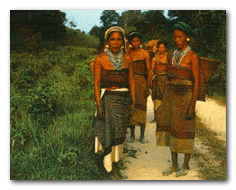
The overwhelming majority of Bangladeshis are ethnic Bengalis, comprising 98% of the population.[82] The remainder are mostly Biharis and indigenous tribal groups. There is also a small but growing population of Rohingya refugees from Myanmar around Cox's Bazaar, which Bangladesh seeks to repatriate to Myanmar. The indigenous tribal peoples are concentrated in the Chittagong Hill Tracts in the southeast. There are 13 tribal groups located in this region, the largest being the Chakma. The Hill Tracts region has been a source of unrest and separatism since and before the inception of Bangladesh.[83] Outside the Hill Tracts, the largest tribal groups are the Santhals and Garos (Achiks), while smaller groups include the Kaibartta, Meitei, Mundas, Oraons, and Zomi.
DEMOGRAPHY

Nearly all Bangladeshis speak Bangla as their mother tongue and it is the official language.[84] It is an Indo-Aryan language of Sanskrit origin with its own script. English is used as a second language among the middle and upper classes.[85] English is also widely used in higher education and the legal system. Historically, laws were written in English and translated into Bengali until 1987 when the procedure was reversed.[86] The Bihari population speaks Urdu, which was also the language associated with the government prior to separation from Pakistan.

Health and education levels remain relatively low, although they have improved recently as poverty (31% at 2010[87]) levels have decreased. Most Bangladeshis continue to live on subsistence farming in rural villages. Health problems abound, springing from poor water quality and prevalence of infectious diseases. The water crisis is acute, with widespread bacterial contamination of surface water and arsenic contamination of groundwater.[88] Common diseases include malaria, leptospirosis and dengue. The literacy rate in Bangladesh rose to 53.5% in 2007.[89] There is gender disparity, though, as literacy rates are 50% among men and 31% among women, according to a 2004 UNICEF estimate.[89] Among the most successful literacy programs are the Food for education (FFE) introduced in 1993,[90] and a stipend program for women at the primary and secondary levels.[91]

The main religion practiced in Bangladesh is Islam (89.7%), but a significant percentage of the population adheres to Hinduism (9.2%).[92] The majority of Muslims are Sunni. There is a small Shia and an even smaller Ahmadiyya community. Ethnic Biharis are predominantly Shia Muslims. Sufi influences in the region go back many centuries.[93] Other religious groups include Buddhists (0.7%, mostly Theravada), Christians (0.3%, mostly of the Roman Catholic denomination), and Animists (0.1%). Bangladesh has the fourth largest Muslim population after Indonesia, Pakistan, and India, with over 130 million. Bangladesh was founded as a secular state, but Islam was briefly made the state religion, before returning by decree of the High Court to the principles of its 1972 constitution.[94] The High Court also strengthened its stance against punishments by Islamic edict (fatwa), following complaints of brutal sentences carried out against women by extra-legal village courts.[95]
Culture

Main article: Culture of Bangladesh
See also: Public holidays in Bangladesh, Sport in Bangladesh, and Music of Bangladesh

Celebrations of the Pohela Baishakh at Dhaka.

Reflecting the long history of the region, Bangladesh has a culture that encompasses elements both old and new. The Bengali language boasts a rich literary heritage, which Bangladesh shares with the Indian state of West Bengal. The earliest literary text in Bengali is the 8th century Charyapada. Medieval Bengali literature was often either religious (for example, Chandidas), or adapted from other languages (for example, Alaol). Bengali literature reached its full expression in the 19th century, with its greatest icons being poets Rabindranath Tagore, Michael Madhusudan Dutt and Kazi Nazrul Islam. Bangladesh also has a long tradition in folk literature, for example Maimansingha Gitika, Thakurmar Jhuli and stories related to Gopal Bhar, Birbal and Molla Nasiruddin.

The musical tradition of Bangladesh is lyrics-based (Baniprodhan), with minimal instrumental accompaniment. The Baul tradition is a distinctive element of Bengali folk music. Numerous other musical traditions exist including Gombhira, Bhatiali and Bhawaiya, varying from one region to the next. Folk music is often accompanied by the ektara, an instrument with only one string. Other instruments include the dotara, dhol, flute and tabla. Bangladesh also has an active heritage in North Indian classical music. Similarly, Bangladeshi dance forms draw from folk traditions, especially those of the tribal groups, as well as the broader Indian dance tradition.[96]

Bangladesh produces about 80 films a year.[97] Mainstream Hindi films are also quite popular.[98] Around 200 daily newspapers are published in Bangladesh, along with more than 500 periodicals. However, regular readership is low at just under 15% of the population.[99] Bangladeshis listen to a variety of local and national radio programs like Bangladesh Betar. Four private FM radio stations named (Radio Foorti, ABC Radio, Radio Today, Radio Amar) are popular among urban youths. International Bengali language broadcasts include BBC Bangla and Voice of America. The dominant television channel is the state-owned Bangladesh Television, but in the last few years, privately owned channels have developed considerably.

The culinary tradition of Bangladesh has close relations to nearby North-East Indian and Middle Eastern cuisine as well as having its own unique traits. Rice, and fish are traditional favorites. Bangladeshis make distinctive sweetmeats from milk products, some common ones being Rôshogolla, Rasmalai|Rôshomalai, chômchôm and kalojam.

The sari (shaŗi) is by far the most widely worn dress by Bangladeshi women. A guild of weavers in Dhaka is renowned for producing saris from exquisite Jamdani muslin. The salwar kameez (shaloar kamiz) is also quite popular, and in urban areas some women wear western attire. Among men, western attire is more widely adopted. Men also wear the kurta-paejama combination, often on religious occasions, and the lungi, a kind of long skirt for men.

Eid ul-Fitr and Eid ul-Adha, being the most important holidays in the Islamic calendar, are the subject of major festivals. The day before Eid ul-Fitr is called Chãd Rat (the night of the moon) and is often celebrated with firecrackers. Eid ul-Adha is celebrated in the memory of great sacrifice of Prophet Abraham. Major Hindu festivals are Durga Puja, Kali Puja and Saraswati Puja. Buddha Purnima, which marks the birth of Gautama Buddha, and Christmas, called Bôŗodin (Great day), are both national holidays. The most important secular festival is Pohela Baishakh or Bengali New Year, the beginning of the Bengali calendar. Other festivities include Nobanno, Poush parbon (festival of Poush) and observance of national days like Shohid Dibosh and Victory Day.

Education

The educational system in Bangladesh is three-tiered and highly subsidized. The government of Bangladesh operates many schools in the primary, secondary, and higher secondary levels. It also subsidizes parts of the funding for many private schools. In the tertiary education sector, the government also funds more than 15 state universities through the University Grants Commission.

Primary (from grades 1 to 5), Secondary (from grades 6 to 10), Higher Secondary (from grades 11 to 12) and tertiary.[100] The five years of lower secondary education concludes with a Secondary School Certificate (SSC) Examination. Students who pass this examination proceed to two years of Higher Secondary or intermediate training, which culminate in a Higher Secondary Certificate (HSC) Examination.[100] Education is mainly offered in Bangla, but English is also commonly taught and used. A large number of Muslim families send their children to attend part-time courses or even to pursue full-time religious education, which is imparted in Bangla and Arabic in madrasahs.[100]

Bangladesh conforms fully to the Education For All (EFA) objectives, the Millennium Development Goals (MDG) and international declarations. Article 17 of the Bangladesh Constitution provides that all children between the ages of six and ten years receive a basic education free of charge.

Universities in Bangladesh are mainly categorized into three different types: Public university (government owned and subsidized), Private University (private sector owned universities), and International University (operated and funded by international organizations )

Bangladesh has 30 public universities where National University is the Largest one and University of Dhaka, established in 1921, is the oldest university of the country. Bangladeshi universities are affiliated with the University Grants Commission (UGC), a commission created according to the Presidential Order (P.O. No 10 of 1973) of the Government of the People's Republic of Bangladesh.[101]
Sports

Main article: Sports in Bangladesh

Bangladesh team returning to the dressing room at the Sher-e-Bangla Cricket Stadium, Dhaka

Cricket enjoys a passionate following in Bangladesh and it is the most popular sport followed by football (soccer). The national cricket team participated in their first World Cup in 1999, and the following year was granted elite Test cricket status. But they have struggled to date, recording only three Test match victories,one against Zimbabwe in 2005 and the other two in a series win of 2-0 against the West Indies in 2009.[102] In July, 2010, they celebrated their first ever win over England in any form of match. Later in 2010,they managed to whitewash New Zealand for the first time in history. In 2011, Bangladesh co-hosted the ICC Cricket World Cup 2011 with India and Sri Lanka.

In Asian Games 2010 in Guangzhou they defeated Afghanistan to claim Gold Medal in the first ever cricket tournament held in Asian Games. Hadudu (Kabaddi) is the national sport of Bangladesh. Other popular sports include field hockey, tennis, badminton, handball, basketball, volleyball, chess, shooting, angling and carrom. The Bangladesh Sports Control Board regulates 29 different sporting federations.